
So I left Glasgow bright and early on Monday morning for a 3 hour train trip into the Scottish highlands to the little seaside town of Oban where I would be staying for three nights.
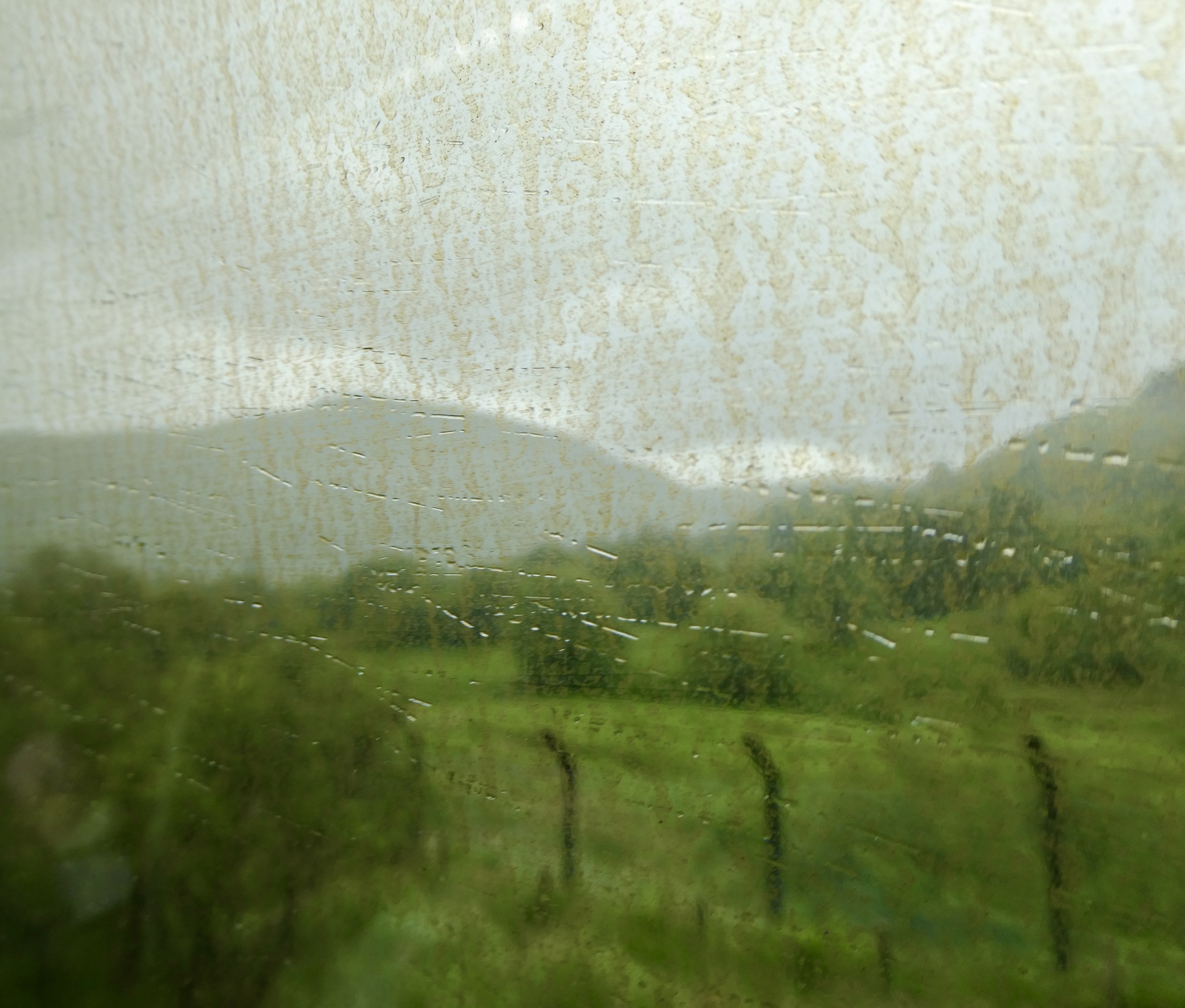

The journey took me out of the lowlands and through rolling hills past lots of lakes. Eventually we climbed higher through forests and into mist and rain stopping periodically at little towns with funny names like Garelochhead, Crianlarich and Falls Of Cruachan. In fact, when we stopped in Crianlarich, the train split in two with one portion heading on to Oban and the other heading to Mallaig. I took a few pictures along the way, but the dirty windows and rain meant sucky pictures, but they give you an idea what I was looking at on the trip.


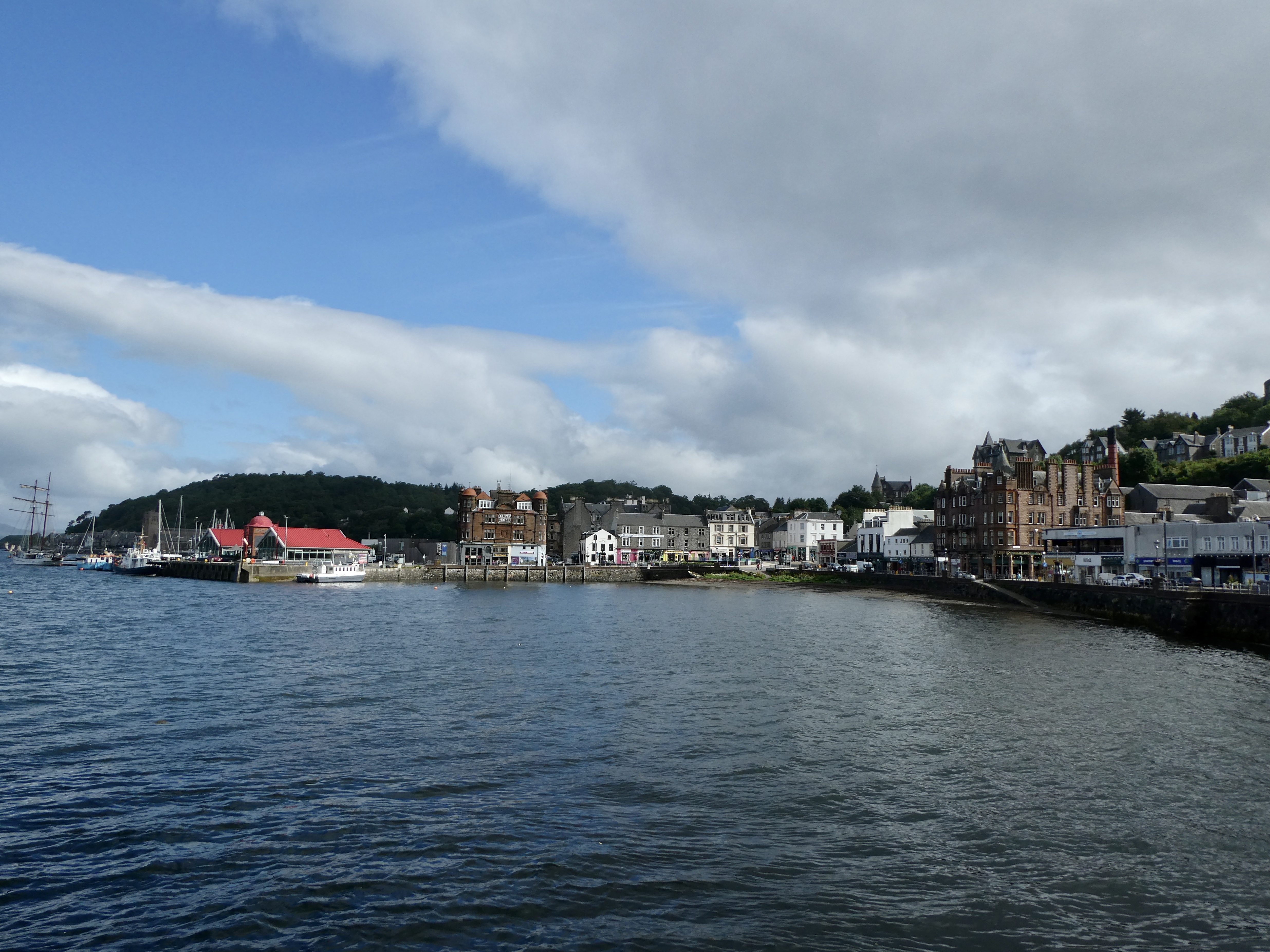
Eventually we pulled into little Oban and I walked across the street to my waterfront hotel. And of course my room was not ready, so I dumped my luggage and began a little tour around town. Somehow I stumbled on the most popular little seafood stand across from the ferry. I proceeded to have platter of the most delicious mussels (so fresh they were literally hauling them off the boat and dumping them into pots). It doesn’t get much better than standing under a little awning downing mussels cooked in butter and white wine. YUM.

And there was of course a ton of other choices, like prawns, crab, langostines, lobsters and on and on. I plan to come back for dinner on Thursday.


So with lunch out of the way, I wandered around the little shops. I eventually stopped in the tourist office and got a map as well as information on how to hike the island of Kerrera, which I planned to do on Tuesday. After the quick visit in the tourist office, I took a walk up to the hill overlooking Oban where McCaig’s Tower lies some 230 fee above sea level. Now McCaig’s Tower looks like the Colosseum, but was actually built by a local banker to honour his family and to provide work to local stone masons during the winter months. Construction began in 1897, but when Mr. McCaig died in 1902, the work ceased. So the “tower” was never completed. Today, it provides a magnificent viewpoint to the little town and surrounding area.


Now while my hike up was uneventful, by the time I reached the tower, the winds had picked up, the temperature had dropped and it began pelting rain. Fortunately, I had my rainpants on and was able to find a “wee” bit of shelter under the doorway of one of the portals. Ten minutes later it was over, but man that wind was bitter.

I headed back down the hill and decided I had seen just about all there was to see in the little town. I opted to go sit in the hotel bar, grab a drink and relax. This decision, turned out to be a good choice because the wind and rain came back not once, but twice. Yuck. I ended up deciding to call it an early day because I knew that Tuesday was going to be a bit exhausting as I was planning to hike the southern portion of the island of Kerrera, an approximately 7 mile loop.

Anyway, I was up by 7:30 the next morning and low and behold, there was blue sky! It looked like it was going to be a nice day. YAY! I packed up my backpack for the day, grabbed some breakfast and found a cab to take me the 2 ½ miles down the road to the Kerrera ferry, which had its next departure at 10:05.


I hopped on the little ferry (which only takes 12 passengers) and sailed across the bay in the sunshine in under 5 minutes. Once on the little island, I took a quick look at the map and reread the instructions the tourist office had provided for following the various paths around the island. I planned to follow the southern route to Gylen Castle, a castle built by the Clan MacDougall and completed in 1582. The castle did not last long, however, as it was under seige and attack almost from the start and just 65 years later was destroyed in 1647. Nevertheless, the remains have become a bit of a tourist attraction with hikers walking to the other end of the island to take a look.
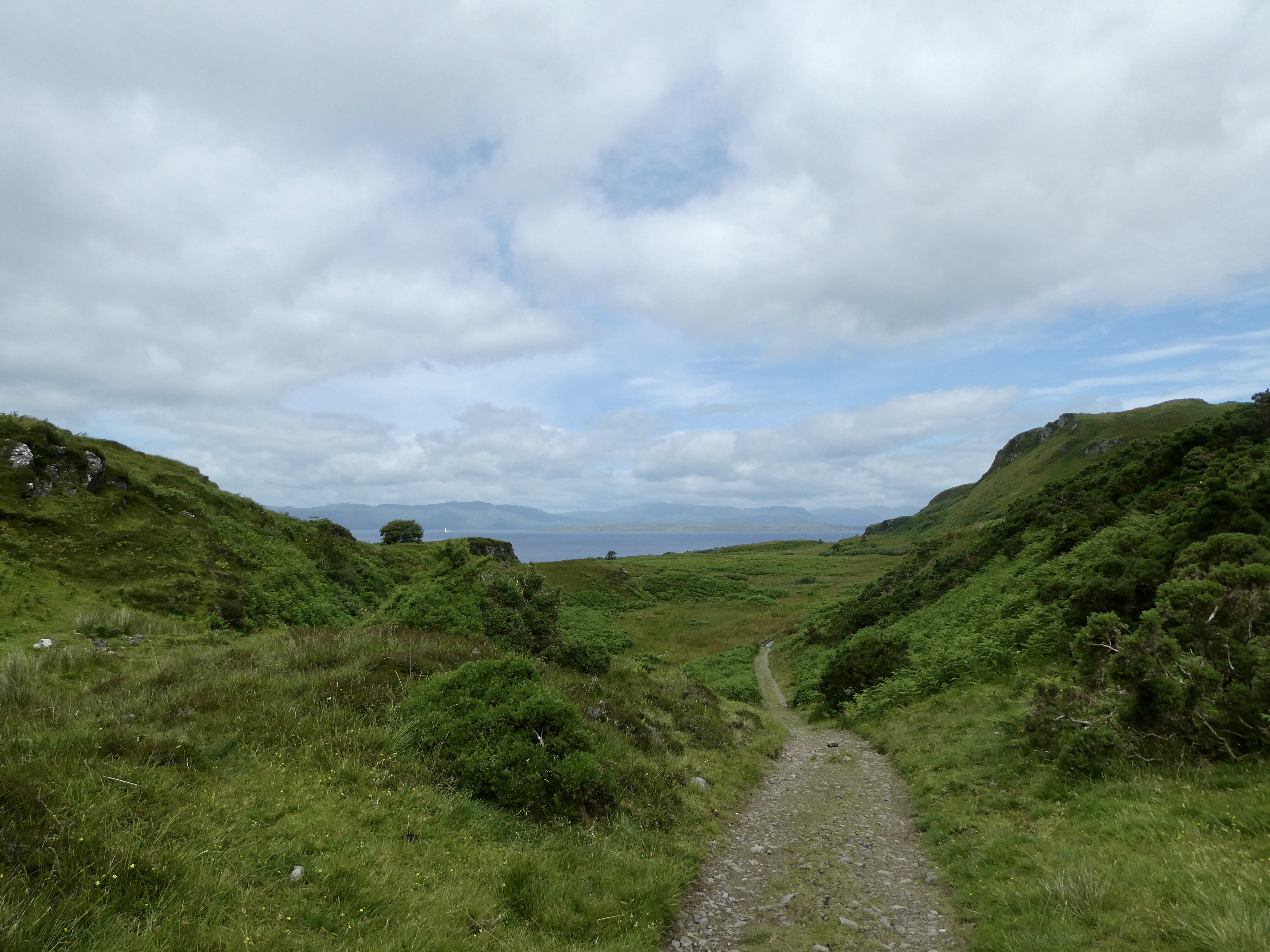
So with the info I needed under my belt, I set out on a lovely and very flat path which followed the coastline.


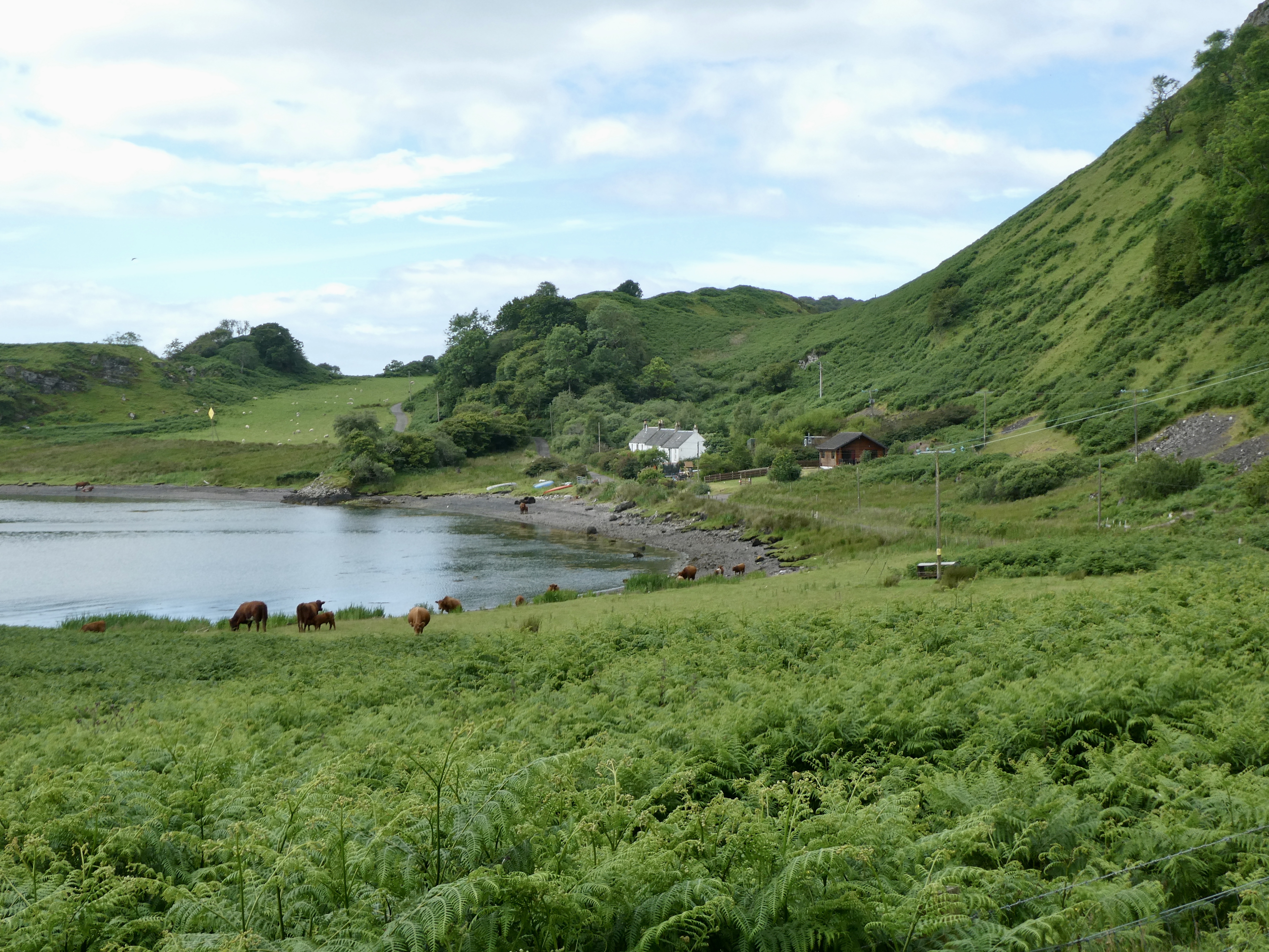
The first hour of the hike was really enjoyable. The path was super easy and there were lots of sheep, rabbits and cows to entertain me. The sheep were particularly funny because as soon as I approached the sheep starting baaaaing and running away … except for one rather large male sheep who decided he was going to stare me down. I started to get my camera out to take a picture and this bugger starts to come at me. Yikes. I stopped and stood still and he immediately stopped. Then he slowly and I mean slowly walked past me. Once he was by me he ran back into the field, and I was able to continue on my way. Fortunately, that was the only close encounter of the day.
I passed a total of two houses on this first part of the walk and even stopped a little boy from running out of his house and down the path (his mum was not far behind).


Anyway, about ¾ of the way between the ferry terminal and the tip of the island, the path began to cut inland and head up into the hills. The path was still quite good and most of the incline was gentle and not too severe. Along the pathway, I would periodically have to open and close a gate, I presume to keep the sheep in or out, and on the top of these gates there would be a teapot. Apparently, near the castle there is a tea house. Unfortunately, for me, the tea house is closed on Tuesdays so no tea for me!
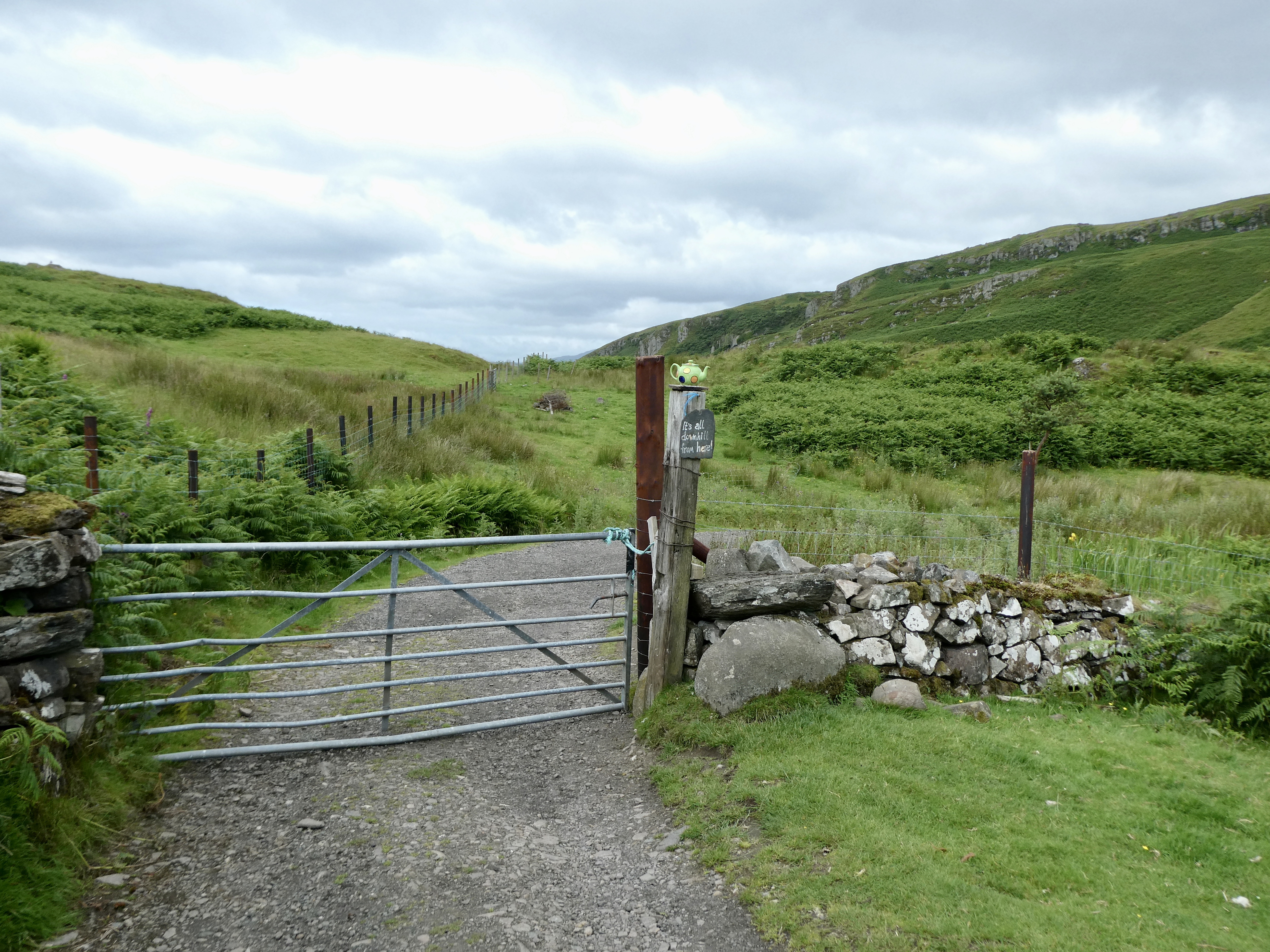


Nevertheless, the tea pots provided me with a bit of navigation information as they were usually accompanied by a sign describing how far I had come. By about 11:20, I reached a fork in the path. To the right was the tea house and to the left was a sign that said “Castle”. I turned to the left and there it was … the Gylen Castle standing high atop a cliff overlooking the water. Now, unfortunately, it was entirely unclear where I was supposed to go from here since the only thing on my left beyond a little gate was a field filled with sheep. So I pulled out my trusty little guide from the tourist office and it directed me to follow the grass towards the shore. Fortunately, not too far into the walk, a path appeared, which made it easier to follow. And then I spotted a path heading to me left and up the hillside.


Within 10 minutes, I had made it up the hillside and was standing in front of the old ruins of the Gylen Castle with not a soul around. I took some pictures and then wandered down some steps into the old ruins. I climbed a staircase and ended up in what may have been some kind of family room with an enormous fireplace. (At this point, I felt like I had just ended up in an episode of Outlander. – If you don’t get the reference, watch the show. Spectacular and required viewing for anyone travelling to Scotland.)
Now the one overarching theme in the old stone structure was how everything, and I mean everything, was covered in green moss and mold. As a result, I did not spend a lot of time in the building, and instead took some quick pictures and then went outside to admire the view.


I ended up staying about 15 minutes at the site and just as I was leaving another couple showed up and by the time I had hiked down, there was a group of 4 who showed up. Glad I arrived when I did.


So this is the part of the hike that got really interesting. Rather than double back, I opted to hike around to the other side of the island and then cut across the middle of the island and back to the ferry dock. Fortunately, this is where the directions came in handy again as I am certain there is no way I would have found my way without them. First up was a hike along the rocky, pebbly shore and then I had to cut through a bunch of long grasses through to a grass path splitting two little hillsides. Then I had to cross a VERY wet bog, where I met up with two little lost lambs and finally, finally, finally I rejoined the main path.


Now the path on this part of the island was nothing like the path to the Castle. This portion of the path was very rocky, very muddy and extremely hilly. I continued on for about a half hour and finally reached a strange looking rock, which the directions told me to look for. At this point, I veered to my right past a house known as Ardmore house and then up, up, up a very muddy, boggy path. Eventually the rocky path turned into a grass path, but this was problematic because the grass was mostly mud.
By now, my hiking boots were covered in mud so it was a relief when I had to cross a little stream. I ended up simply walking through the stream to clean off some of the mud and crap. Oh yeah. Did I mention that I had to dodge cow and sheep poop, which seemed to be literally everywhere on the path.

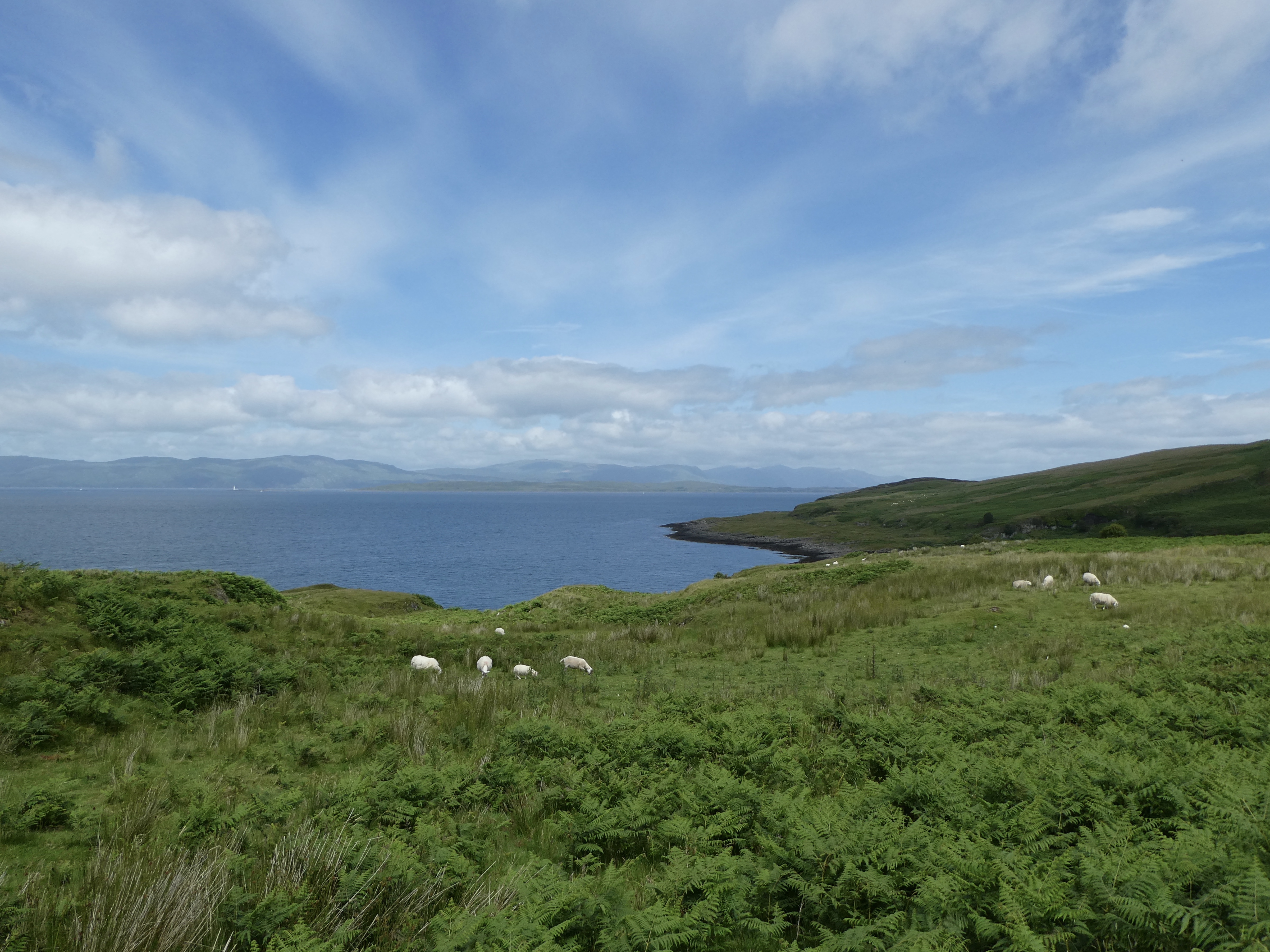
Now while this may sound like not a lot of fun, I can honestly say it was one of the most beautiful hikes I can recall. The views to the islands of Mull and Lismore and the Movern mountains, were spectacular. I could see boats out in the water, a lighthouse and at one point the Oban ferry made a pass by. And of course, there was the ever present and highly entertaining sheep.

As I wound may way down a small hill, I reached the lovely little farm at Barnbruck. I had seen it in the distance, but up close it was absolutely gorgeous. Unfortunately, the elderly farmer did not hear me coming and I scared the bejesus out of him as I walked by. We ended up having a lovely chat. I told him I thought his farm was gorgeous and he told me that on rare days like these (with the sun shining) it was indeed gorgeous, but between November and February he never sees the sun because the hills behind his house block the sun, which does not get high enough in the sky for him to see. Yikes!


Anyway, after the chat I continued on and this portion of the hike was rather rough. While the little pebble path was fine, the hike for the next half hour was literally straight up. I would walk up a hill and walk around a bend on the path only to have to walk yet another hill and this, like I said, continued for a half hour. However, the views were ridiculous. Simply amazing.
By just after 2, I finally reached a little farmhouse and could see the ferry in the distance. A short 25 minutes later, (and I say short because it was mostly downhill), and I was back where I started 4 ½ hours before.


It had been a spectacular, albeit tiring hike. Once on the ferry, I asked a young couple if i could catch a lift into town (rather than waiting for the cab). The lovely Glaswegian couple happily obliged and by 3:00, I was back in my hotel room, cleaning my boots and looking forward to a nice drink to top off the day. Tomorrow will be far less strenuous as I am taking a tour of the three nearby islands: Mull, Staffa and Iona and hopefully finally, finally seeing those darn puffins!