So it was another loooong day on Wednesday for me and Tom as we travelled from Queenstown on an 11 hour 550 km sightseeing tour to Christchurch.
We started the day at 7:45, but our departure was delayed by 10 minutes while we waiting for a single passenger to show up. Now Tom and I had taken up the front row of the bus with me on one side of the isle and Tom on the other side of the isle because the bus was half empty. But when this passenger finally showed up (a Russian woman) she sat down beside Tom and then asked me if she could sit beside me. I said no so Tom was stuck with her for the first half of the trip until she got off at Mount Cook. And this loon kept talking into her phone making it hard to hear the commentary from the bus driver. I finally told her to shut up or move. She shut up.
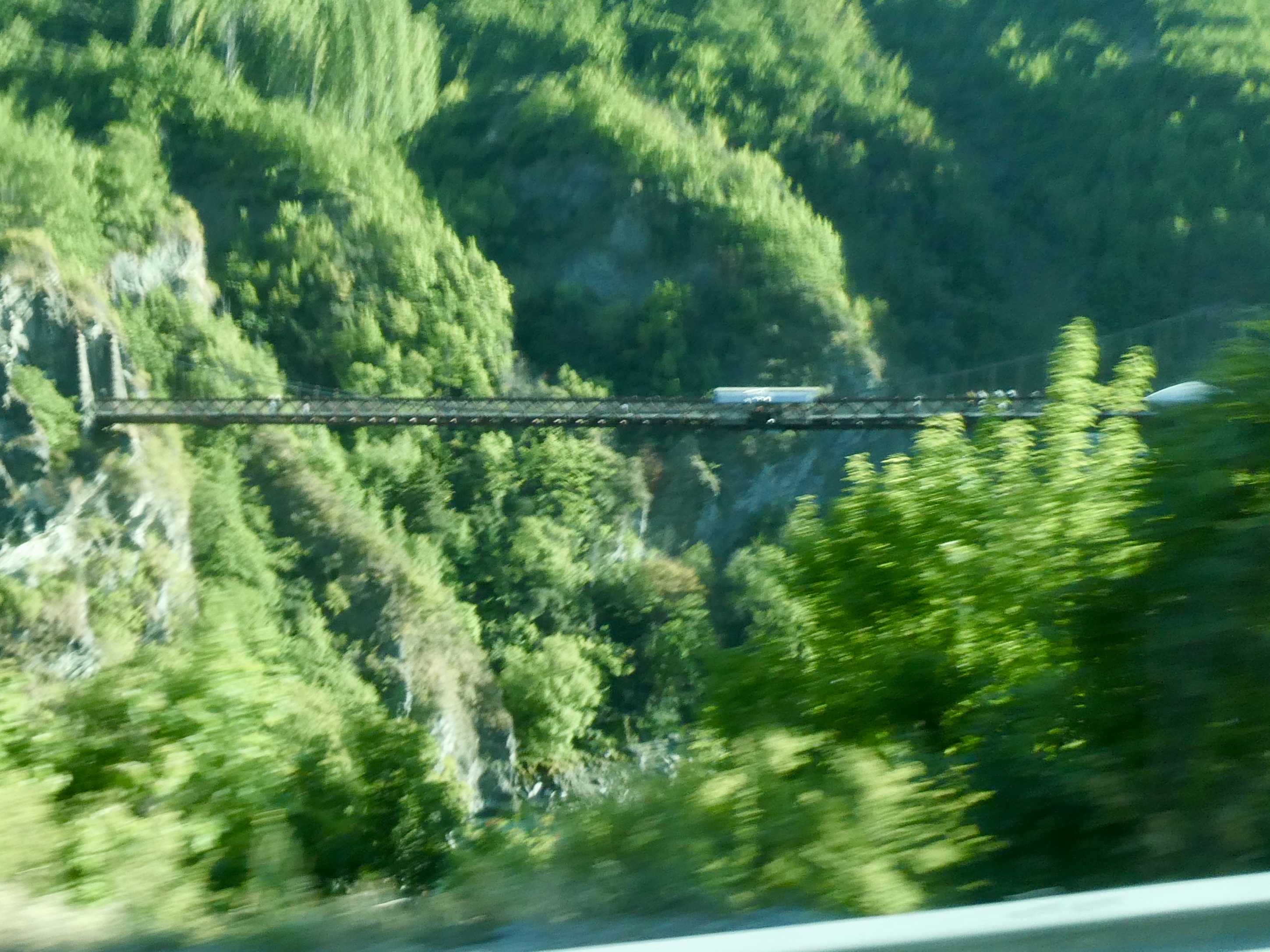
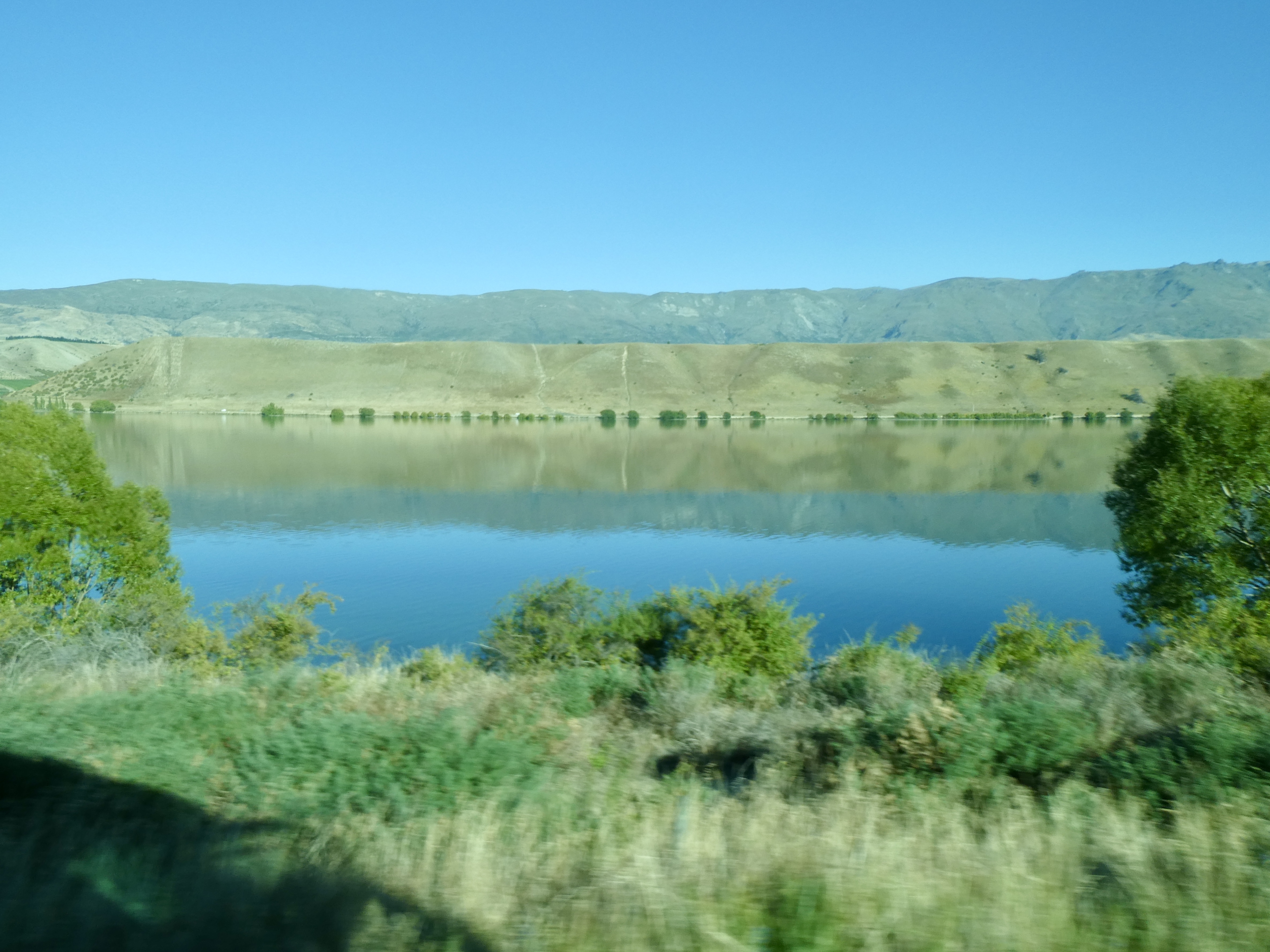
Anyway, once Grant, our driver got under way we travelled basically the same route we had travelled on our wine tour on Sunday first through the Otago wine region of the Gibbston Valley, past the bridge where the very first bungee jump in the world occurred, then by the Roaring Meg waterfall and hydro plant on the Kawarau River, and finally ending up passing through Cromwell and its vineyards and fruit orchards and Lake Dunstan.
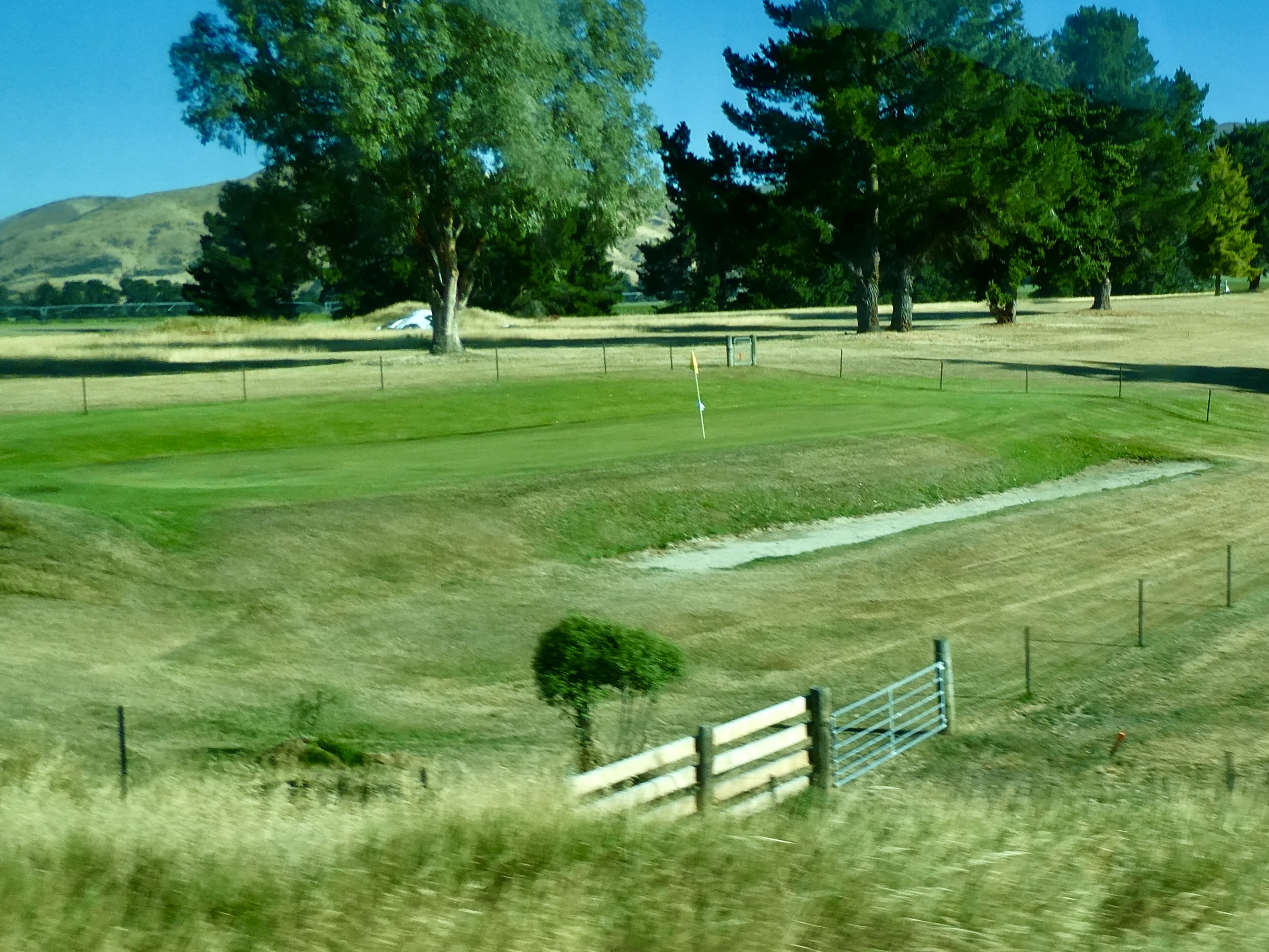
Now after Lake Dunstan, we passed by Tara’s Golf Club, a nine hole golf course that had fences surrounding the greens to keep the sheep (which are allowed to graze on the fairways) off the greens. Classic!

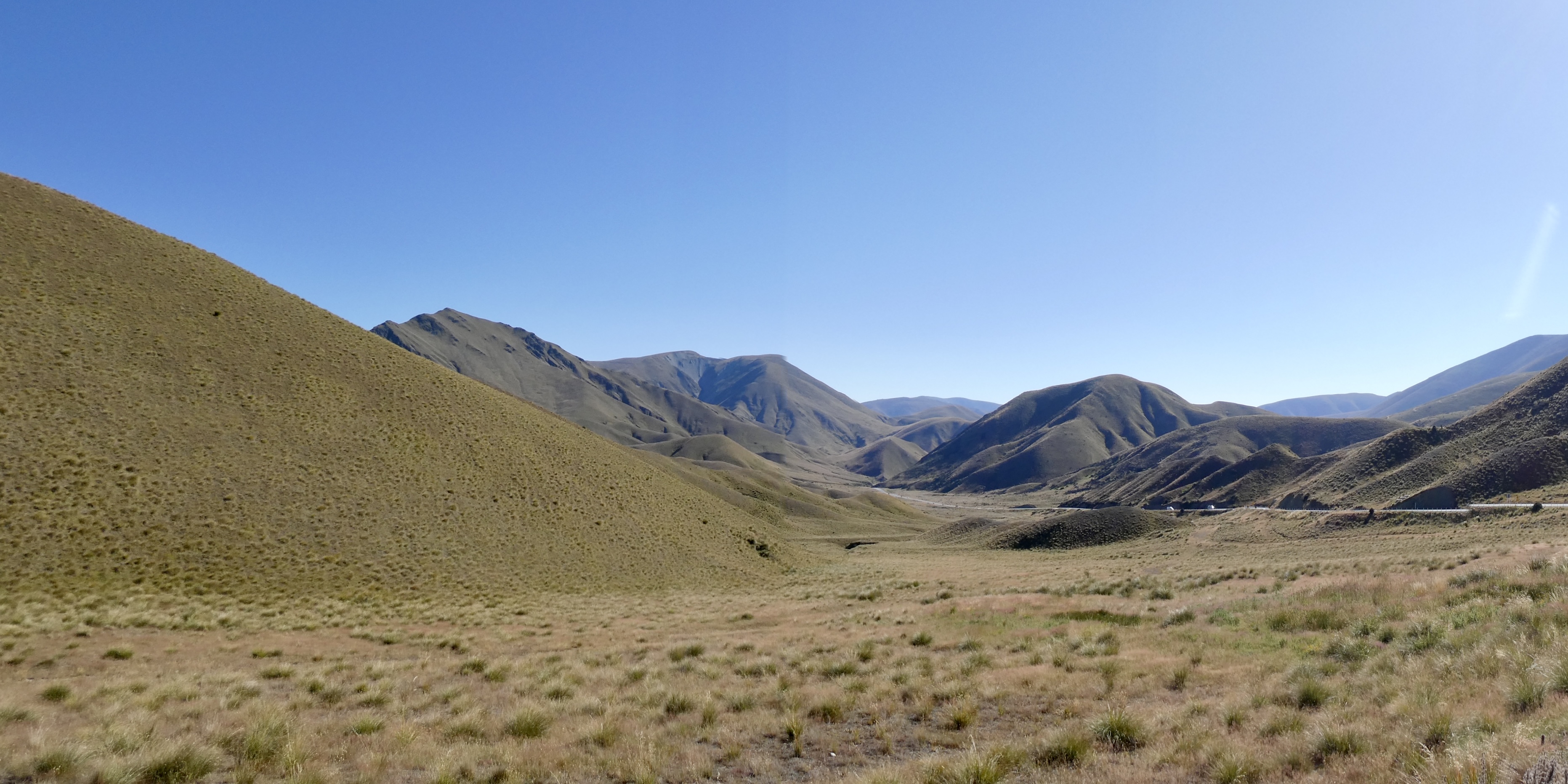
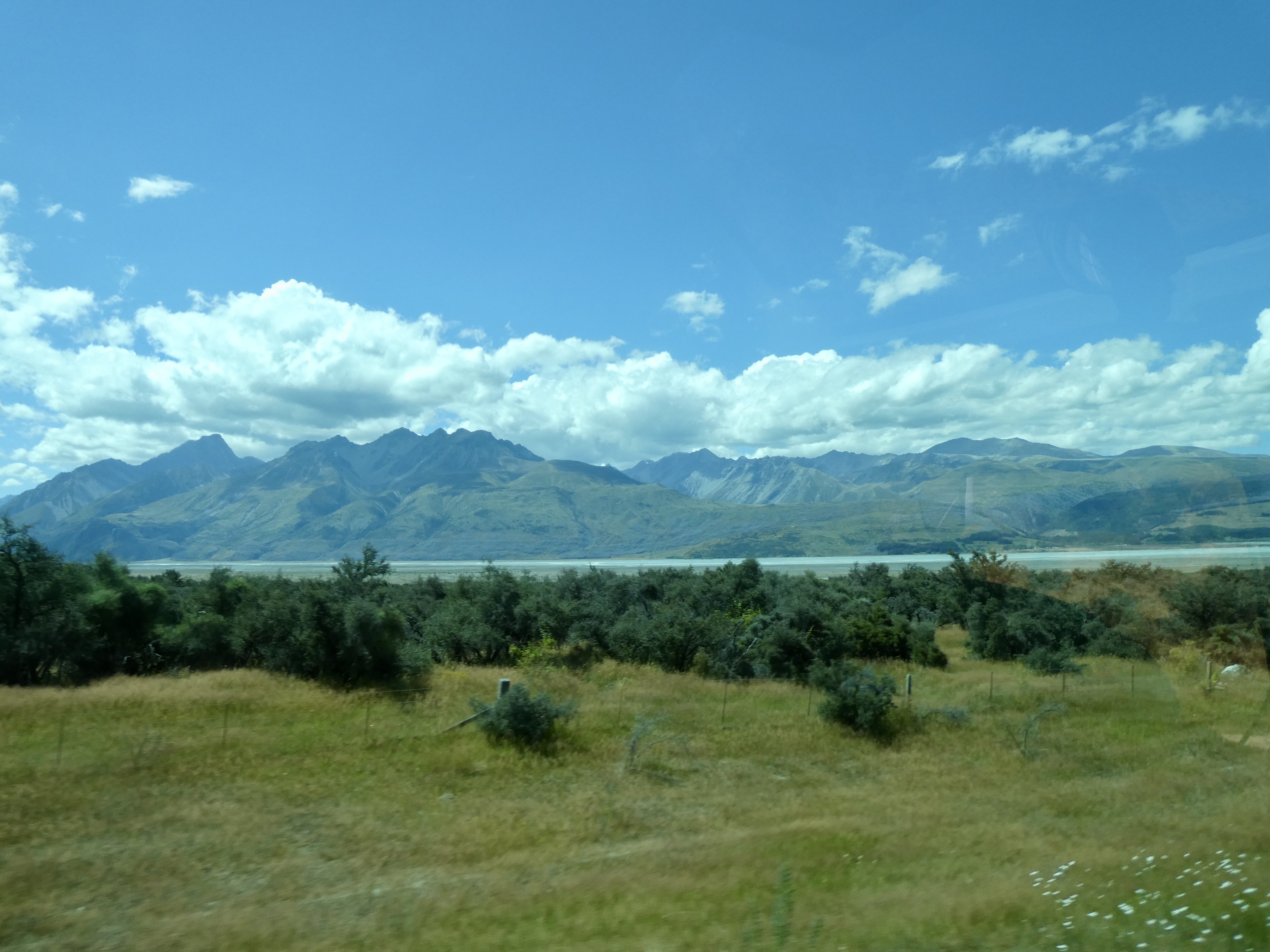
From here, the bus took us out of the lowlands away from the vineyards, fruit orchards and granite hills and into some hilly clay landscape towards the Lindis Pass at 3,500 feet. This area was filled with sheep farms and rugged, mountainous terrain. At one point our driver stopped the bus at the top of the pass and we were able to get out, stretch our legs and take in the magnificent scenery. It really was gorgeous.
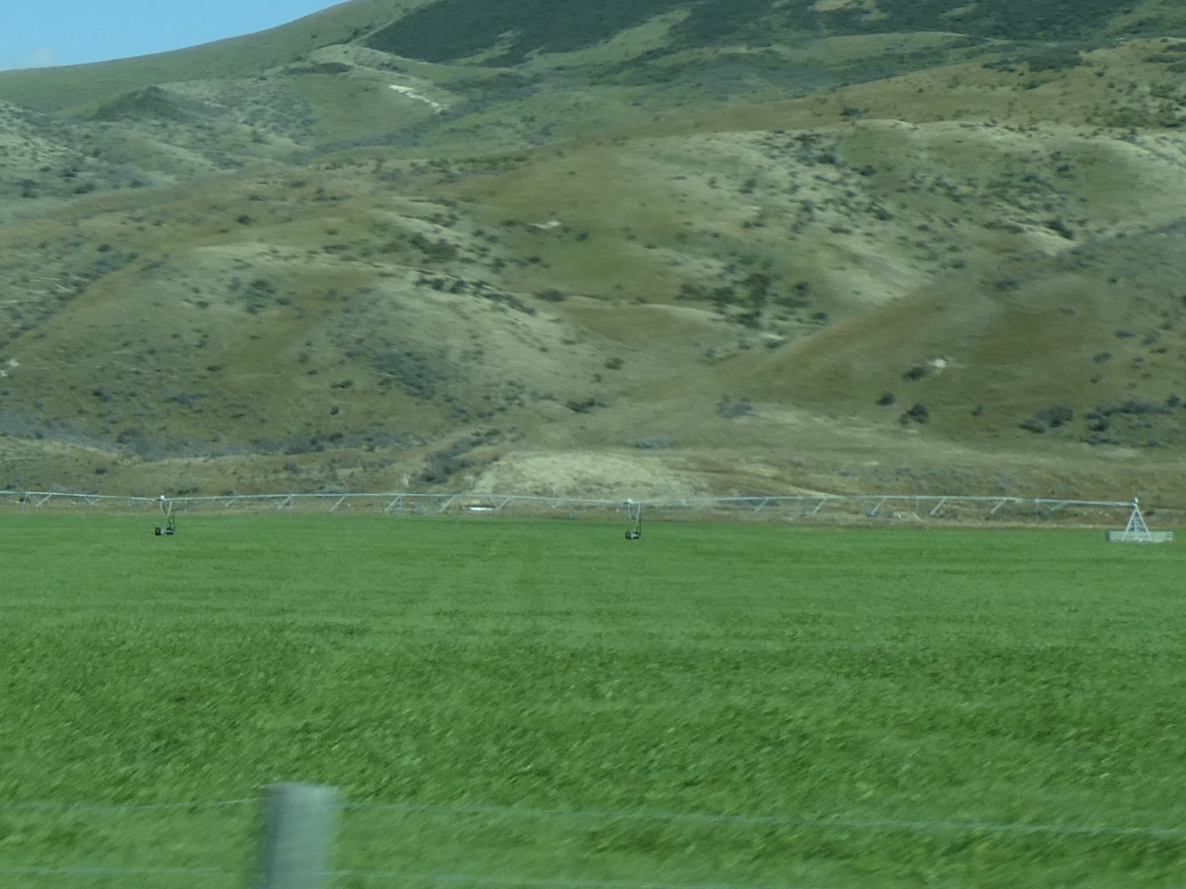
Once back on the bus, we began our descent into the MacKenzie basin filled with yet more sheep and cattle farms (or “stations” as they are called in New Zealand). Now it was here that our driver began to tell us about the irrigation systems used on the farms in the area. These irrigation systems are computerized and run on long steel arm like structures with intermittent sprinkler heads. The entire arm like structure can rotate 360 degrees to cover the entire field or 180 or 45 degrees to cover part of the field. I found the entire process fascinating (and apparently so did our driver as he spent an inordinate amount of time talking about these systems).
By mid morning, we ended up taking a short break for coffee in the small village of Omarama before commencing our journey towards the Southern Alps and Mt. Cook National Park, home to New Zealand’s highest mountain. But before we left our stop in Omarama, we heard about all about Shrek the Sheep from Bendingo Station in nearby Terras.

Shrek was part of a flock of 17,000 sheep and so when he went missing no one notice. It wasn’t until six years later that Shrek was discovered living in a cave barely able to move under the weight of the wool he was carrying. When Shrek was finally sheered, they removed 60 pounds of merino wool and the wool was in such high demand due to Shrek’s notoriety that the wool was auctioned off benefiting numerous childrens’ charities. (Picture credit to Carol Palmer)
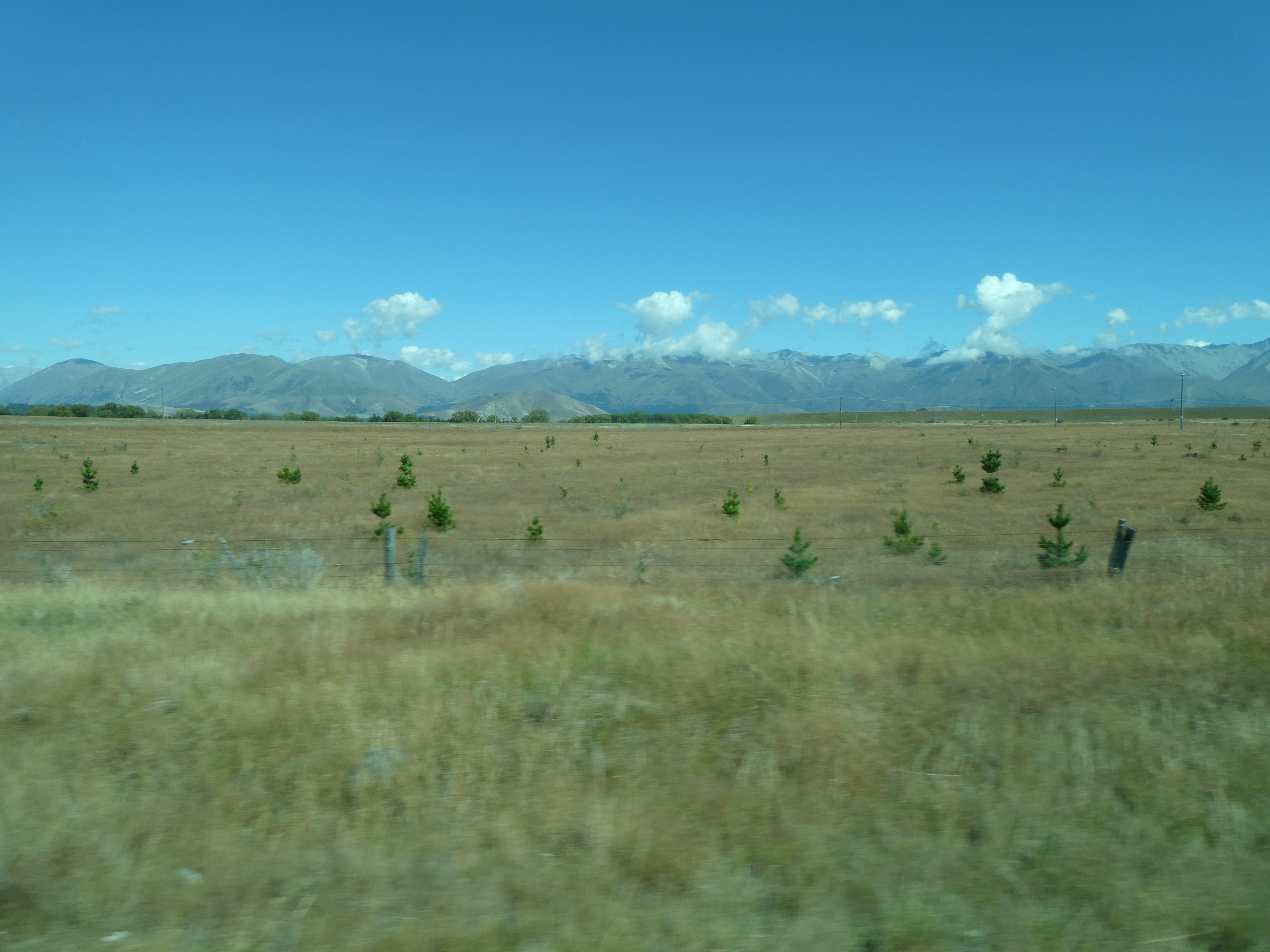
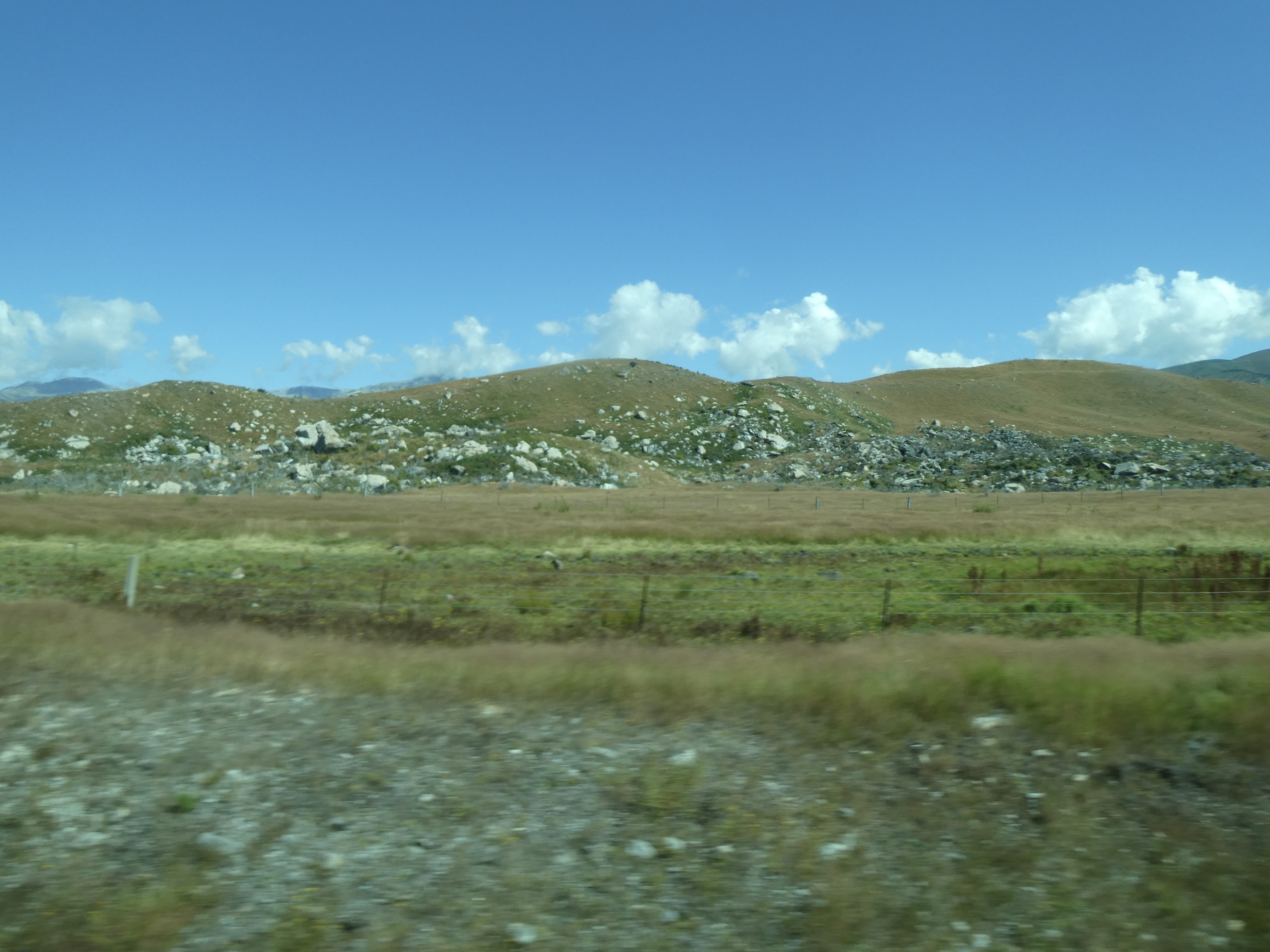
Anyway, once we left Omarama, the trip took us along a narrow road through the high plateau filled with wilding pines that the local farms are trying to eradicate. Everywhere we looked we saw piles of dead pines that had been poisoned by the conservation department and will be burned during the winter.
The area has also, at one time, been teeming with rabbits. When the government did nothing to eradicate the pests, the local sheep farmers living on the high plateau took matters into their own hands. Someone (and to this day those responsible have never been identified) imported a virus that killed the rabbits. New Zealand’s version of the Wild West!
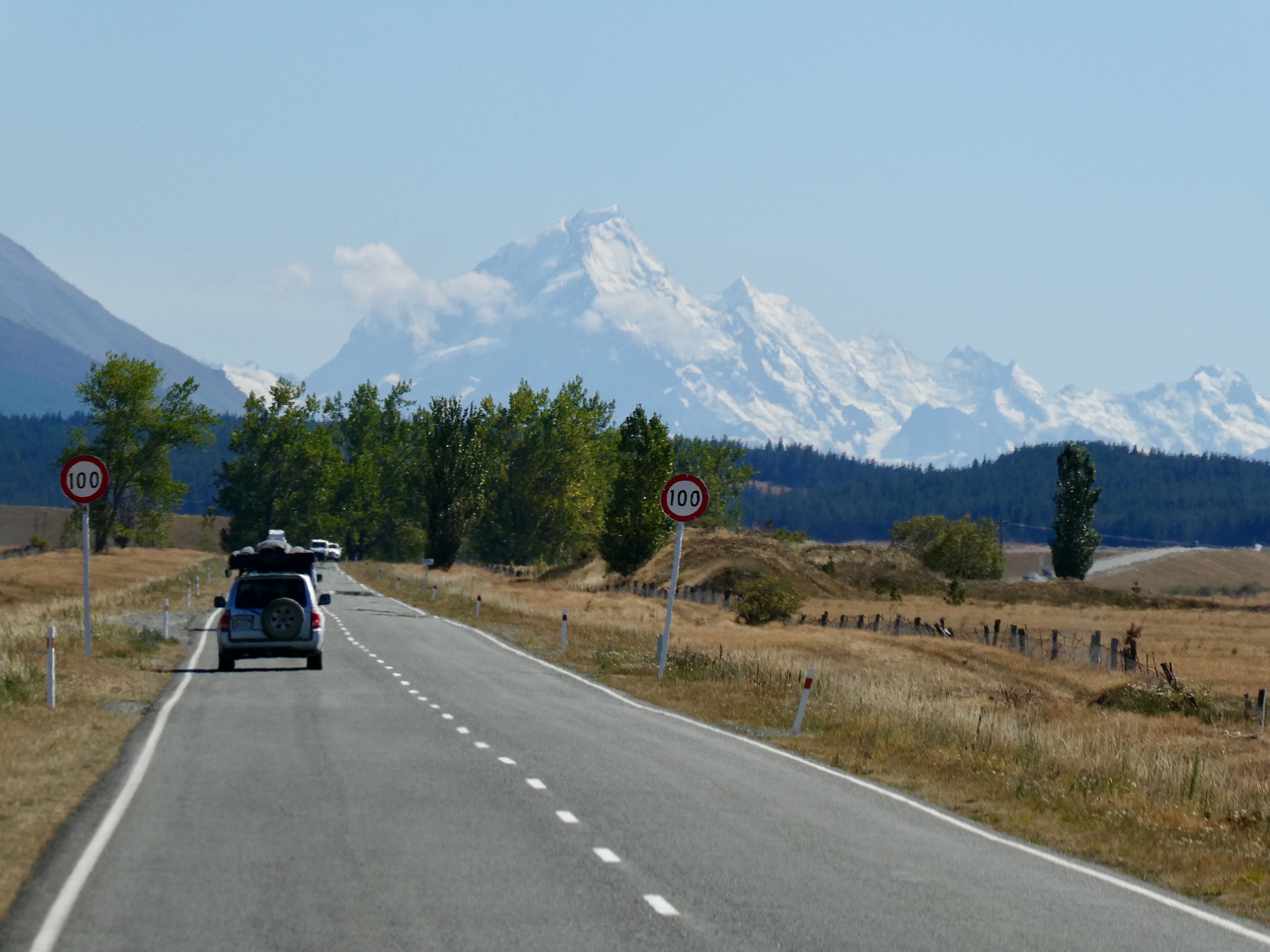

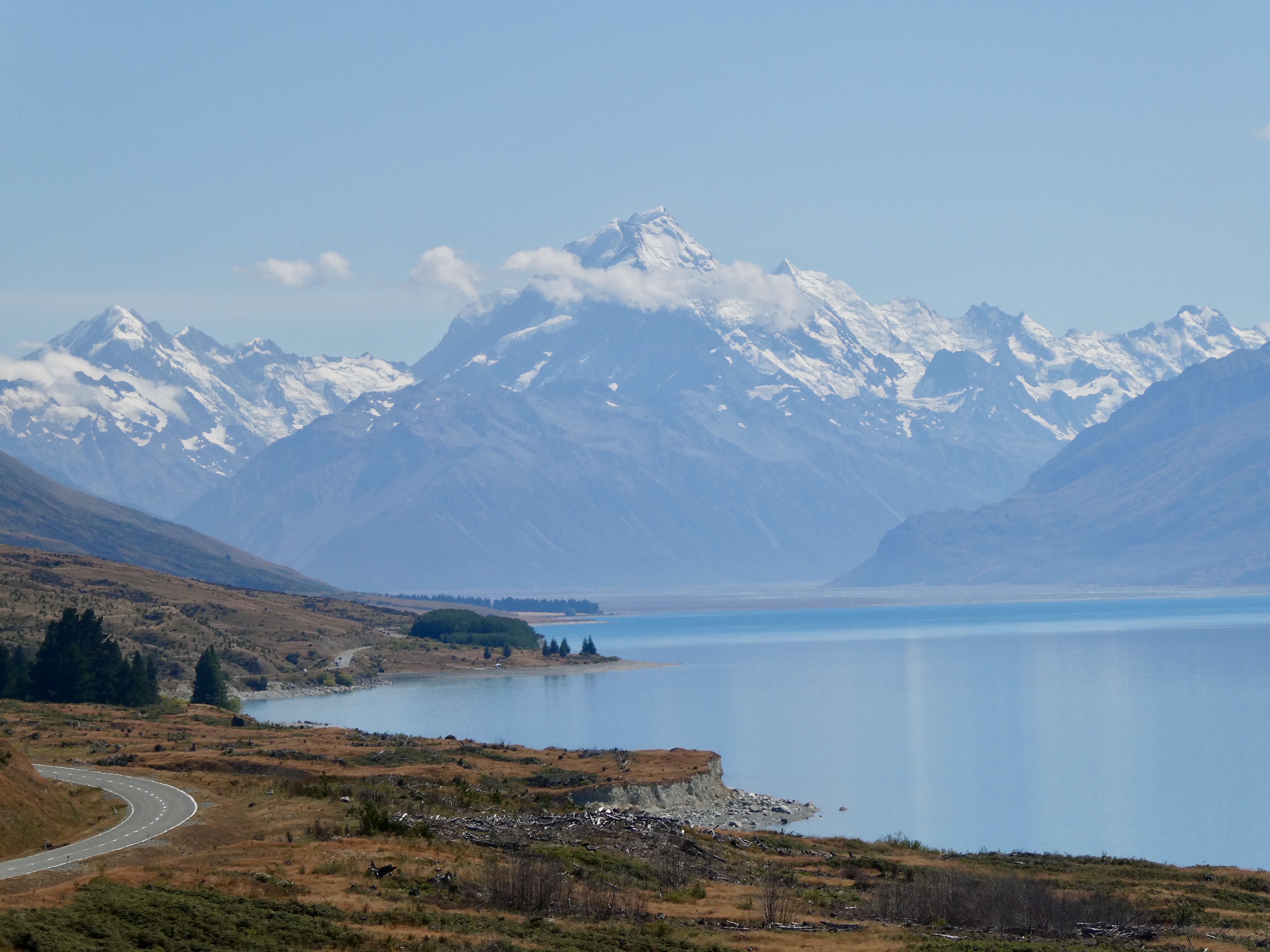
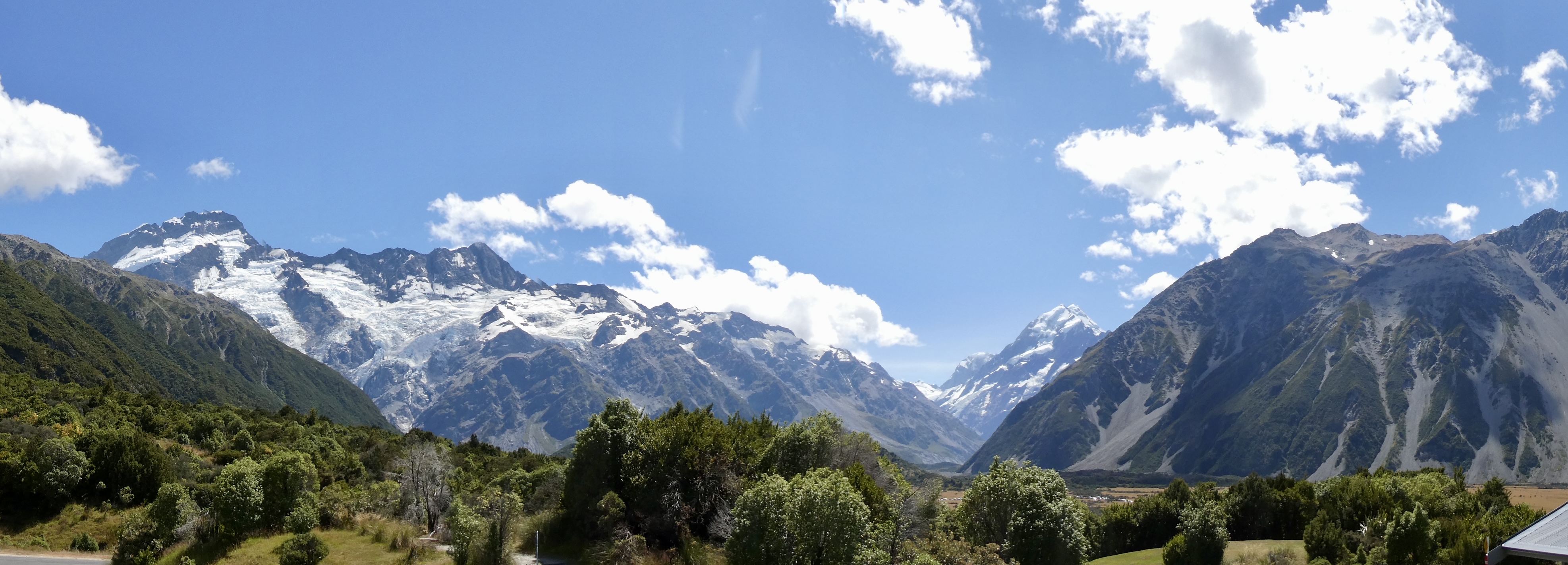
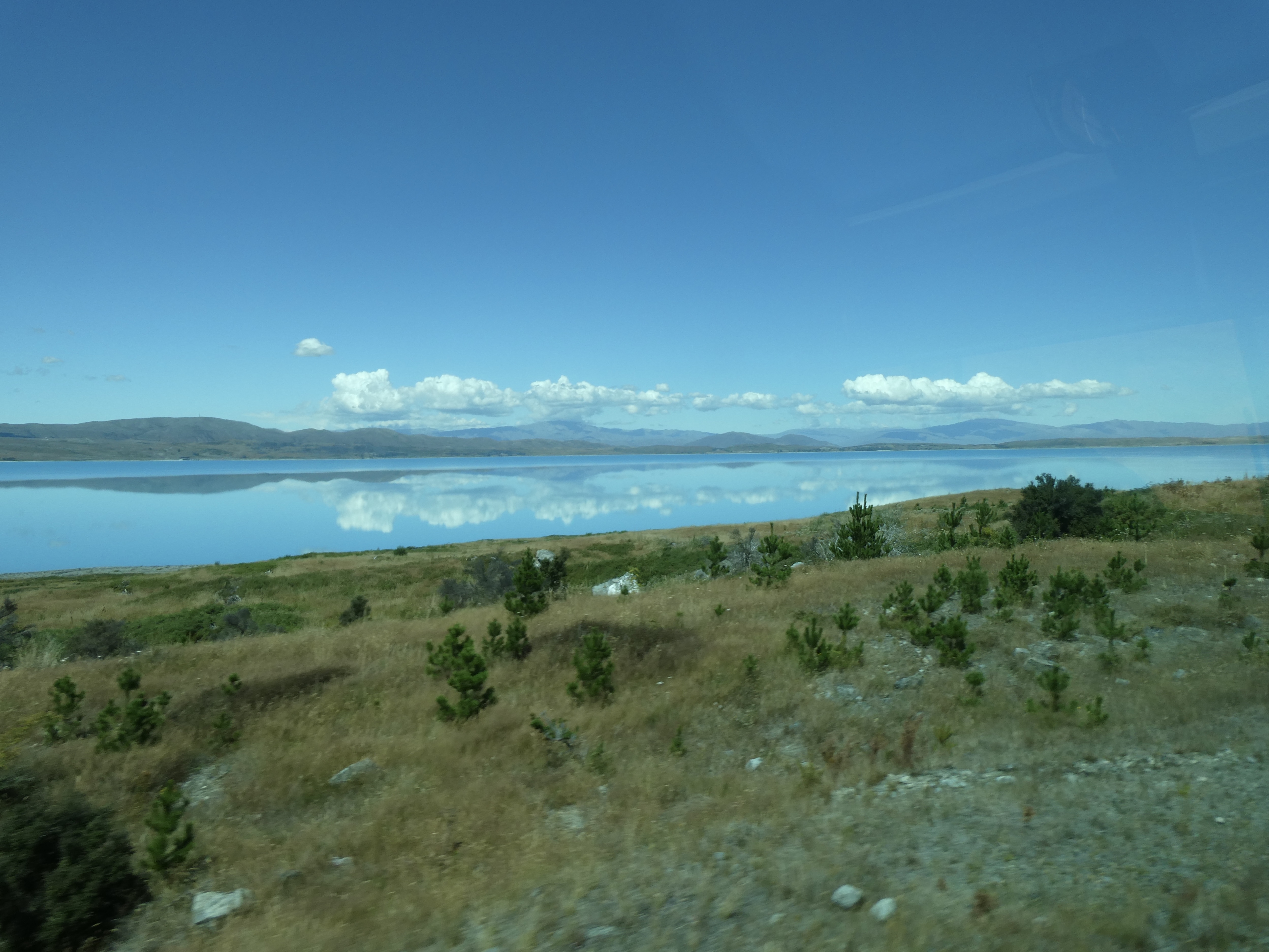
Anyway, after passing by more dead pines, and lots and lots of rock left over from the glaciers, we reached the shores of Lake Pukaki where we made a short stop at Peters Lookout to capture our first views of Mt. Cook. And thankfully, the weather was perfect so we had fabulous, unobstructed views of Mt. Cook. And while the views to Mt. Cook were spectacular, Lake Pukaki was equally gorgeous with aqua blue glacier waters creating a stunning backdrop against the Southern Alps.
And what was really fascinating was the nearby mountains contained scars from thousands of years ago when glaciers covered the entire area. In fact, we could see the flat lines of the mountains where the glaciers had moved over the area.

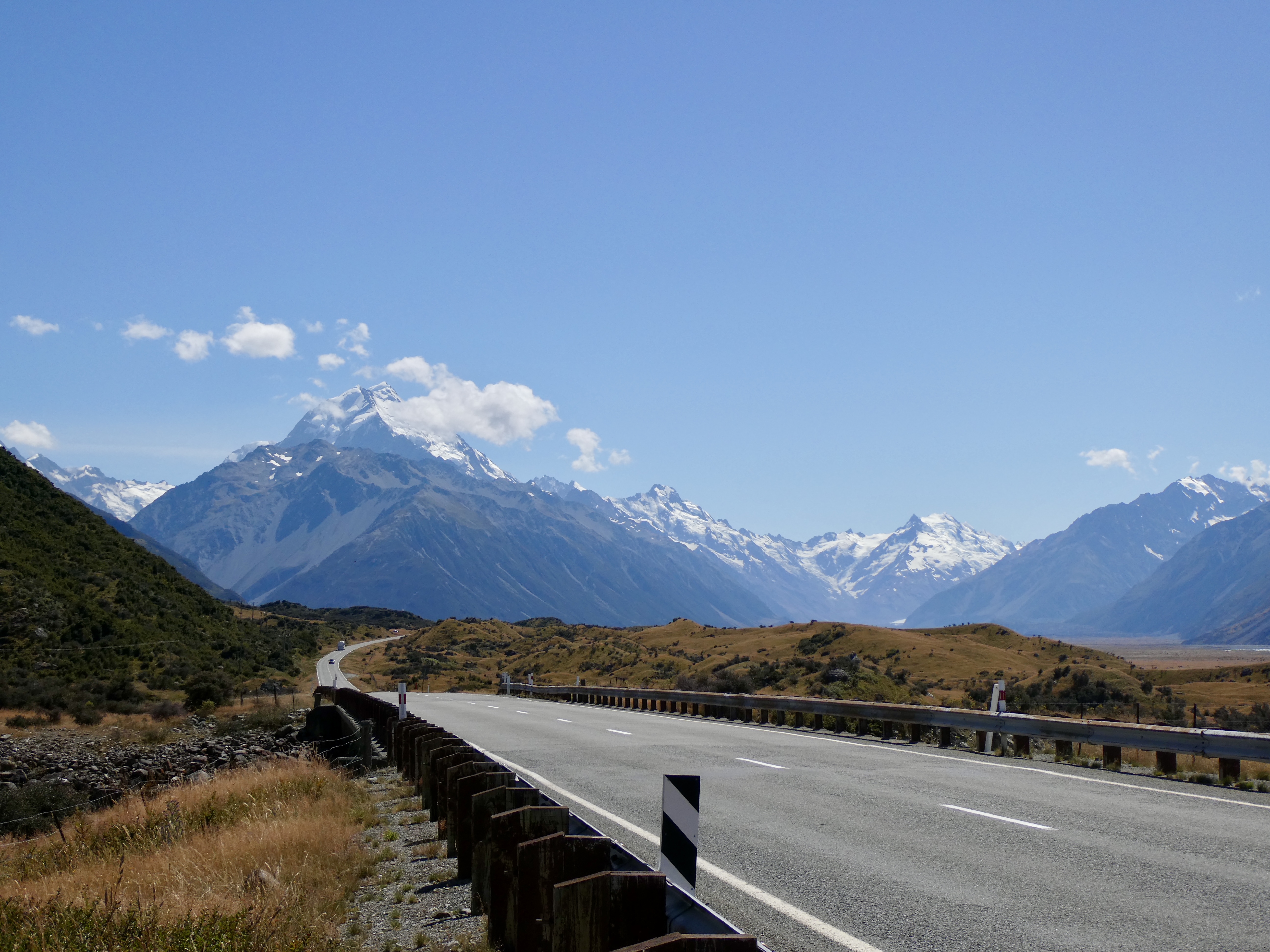
So after the stop at Lake Pukaki, we began the final drive along the very narrow road and one lane bridges crossing the glacier rivers towards Mt. Cook. We made one additional stop by the side of the road to take a look at the Tasman Glacier, that can only be seen at a certain spot in the road, without driving along the Tasman Glacier road (which we would not be travelling on).
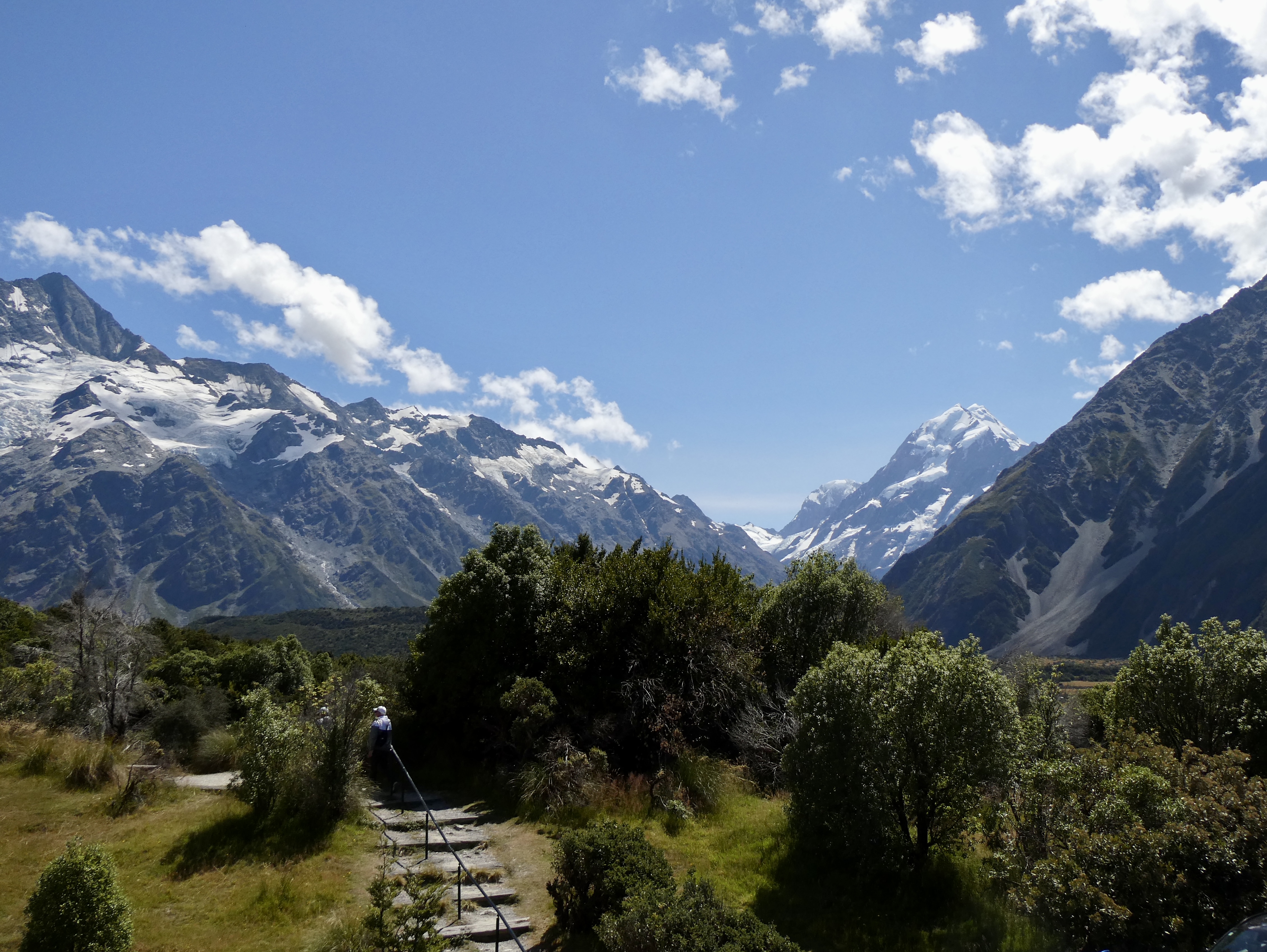
We finally pulled into the little village of Mt. Cook (where crazy Russian lady exited) at 12:30 before driving to the Hermitage Hotel where we spent the next hour and half enjoying a lunch in the shadow of Mt. Cook and the surrounding mountains. The weather was really warm and we had picture perfect views to Mt. Cook from the deck of the restaurant as well as the smaller mountains surrounding Mt. Cook, including Mt. Sefton, Mt. Footstool, La Perouse, Mt. Hicks and the mountain in front of Mt. Cook, Mt. Wakefield.
Now Mt. Cook is also known as Aoraki in Māori culture. And according to Māori legend, the boy Aoraki and his brothers once hit a reef in their canoe. When they climbed to the higher side of the tilting vessel, the cold south wind froze them, turning them into stone. Aoraki and his family now form the Southern Alps, including Mt. Cook.
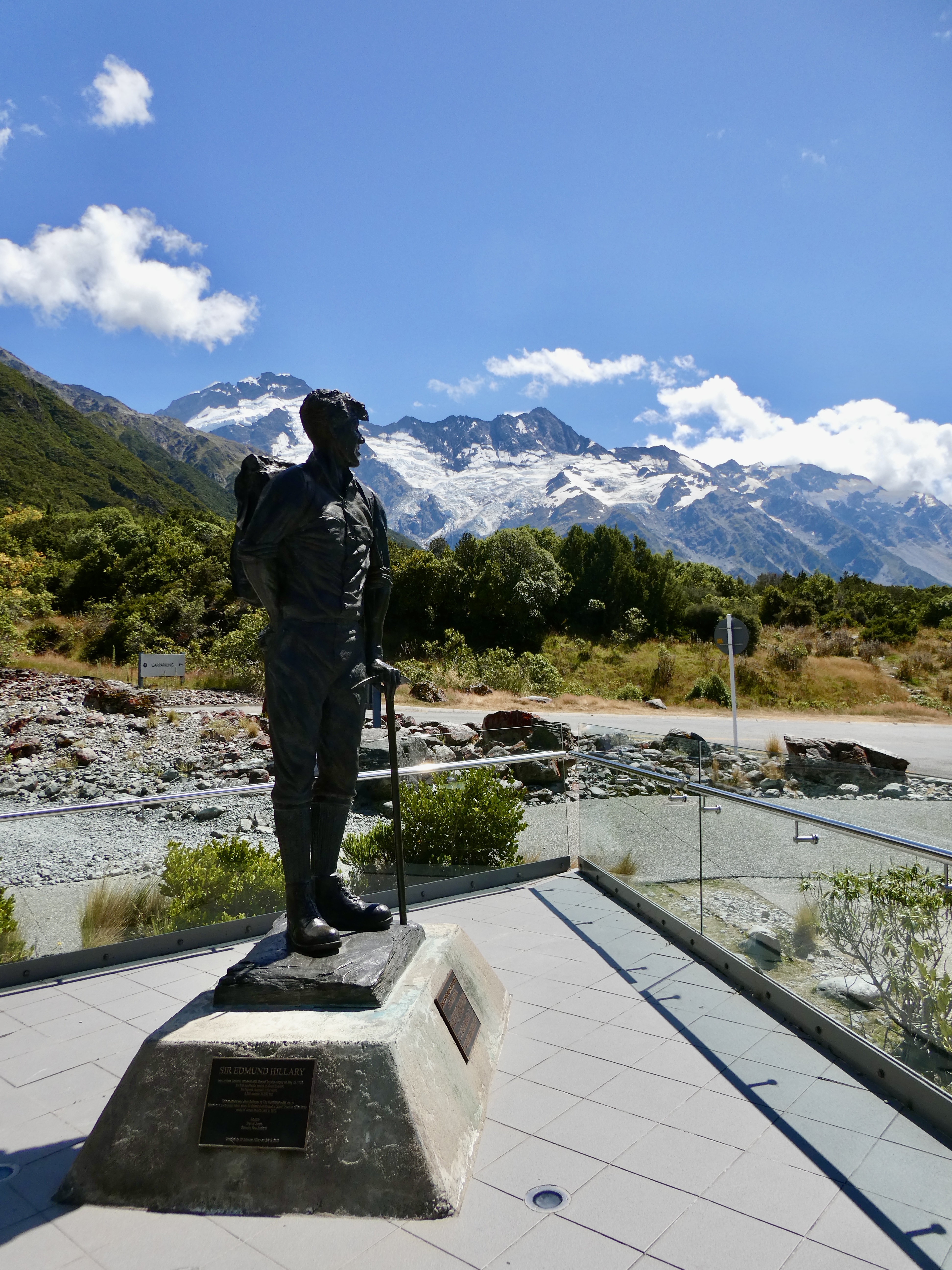
And interesting factoid, Sir Edmund Hillary trained at Mt. Cook before climbing Mt. Everest. There was a statute outside the hotel describing Sir Edmund Hillary’s climb as well as a small museum dedicated to his training and planning for his historic ascent of Mt. Everest.
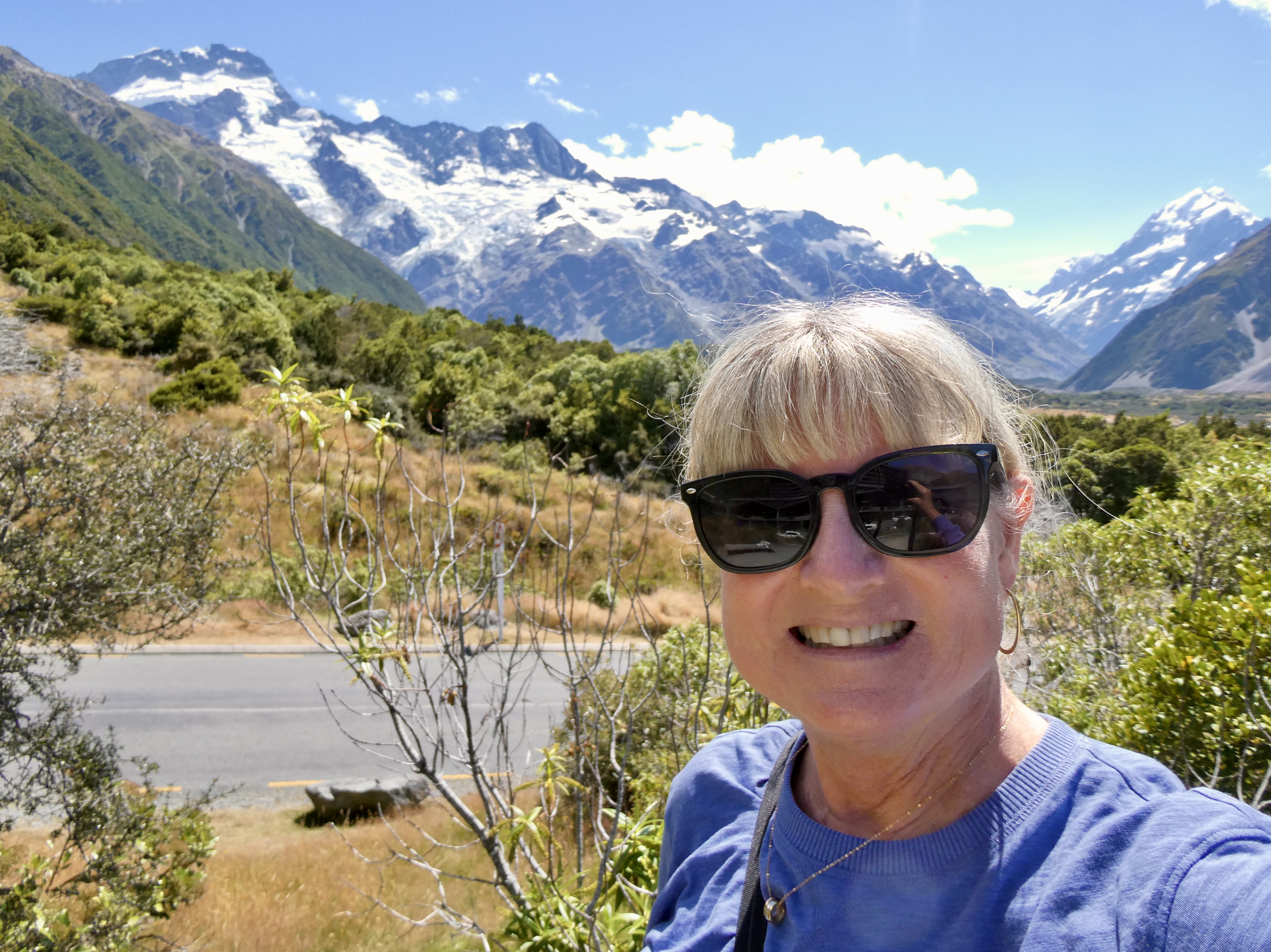
So after lunch, I ended up wandering around the area for a bit taking in the magnificent scenery and the various views of Mt. Cook and its “relatives”.

By 2:00, we were back on the bus and headed back past Lake Pukaki and the dead pines and onto highway 8 driving towards Lake Tekapo. In the distance we could still see Mt. Cook, but by now clouds had moved in obscuring the top of Mt. Cook and the adjacent mountains. Our luck continues!
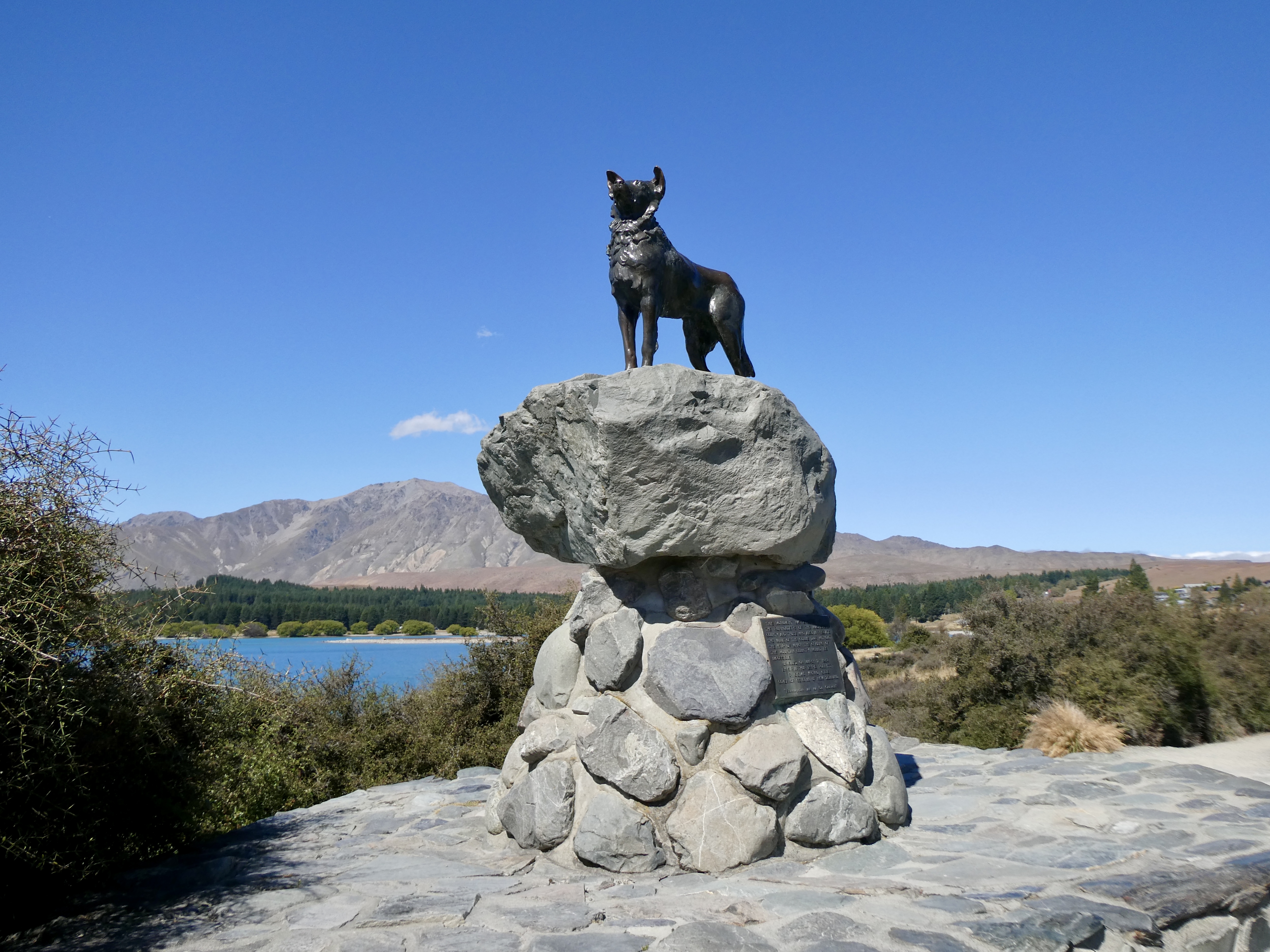
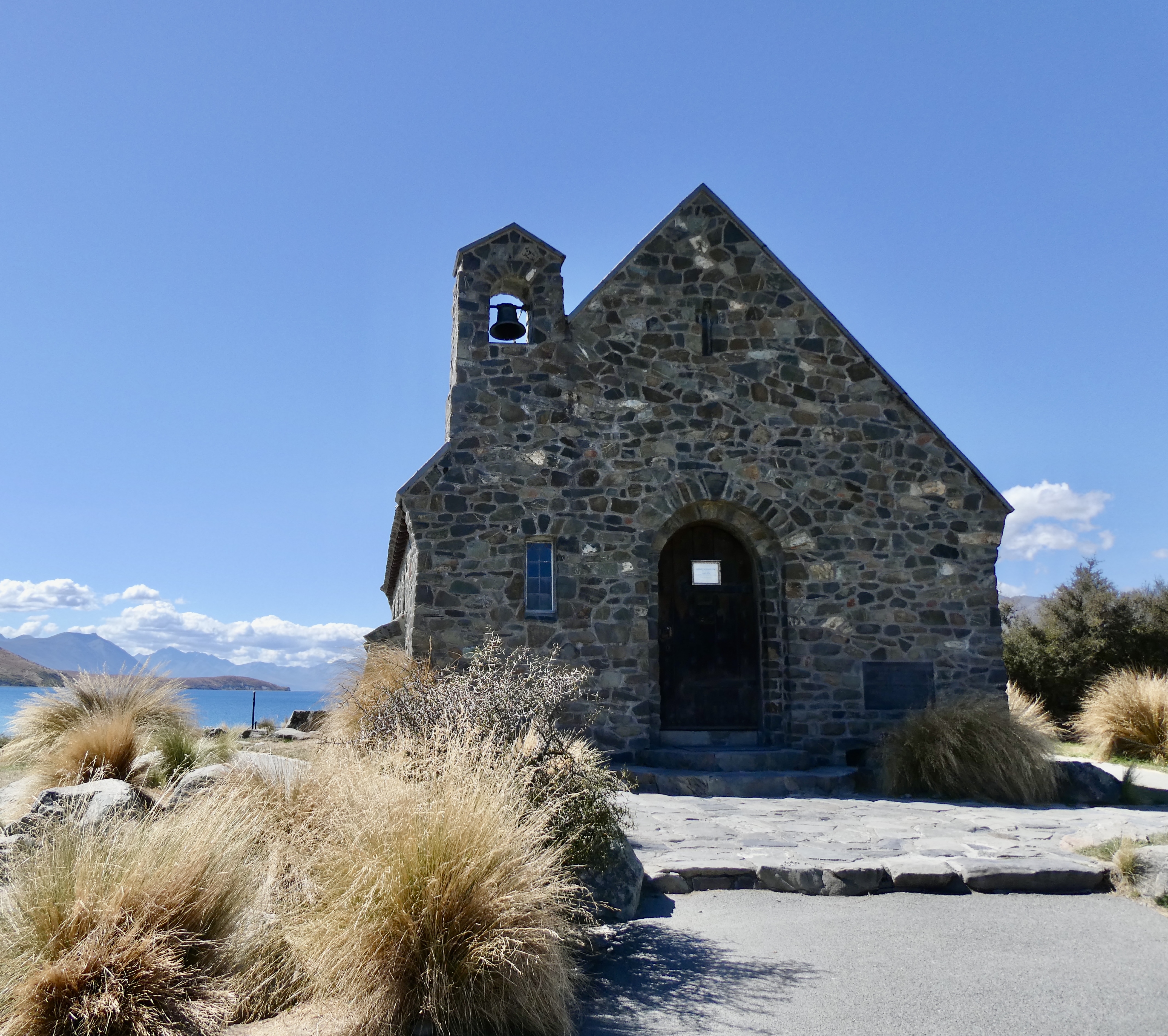
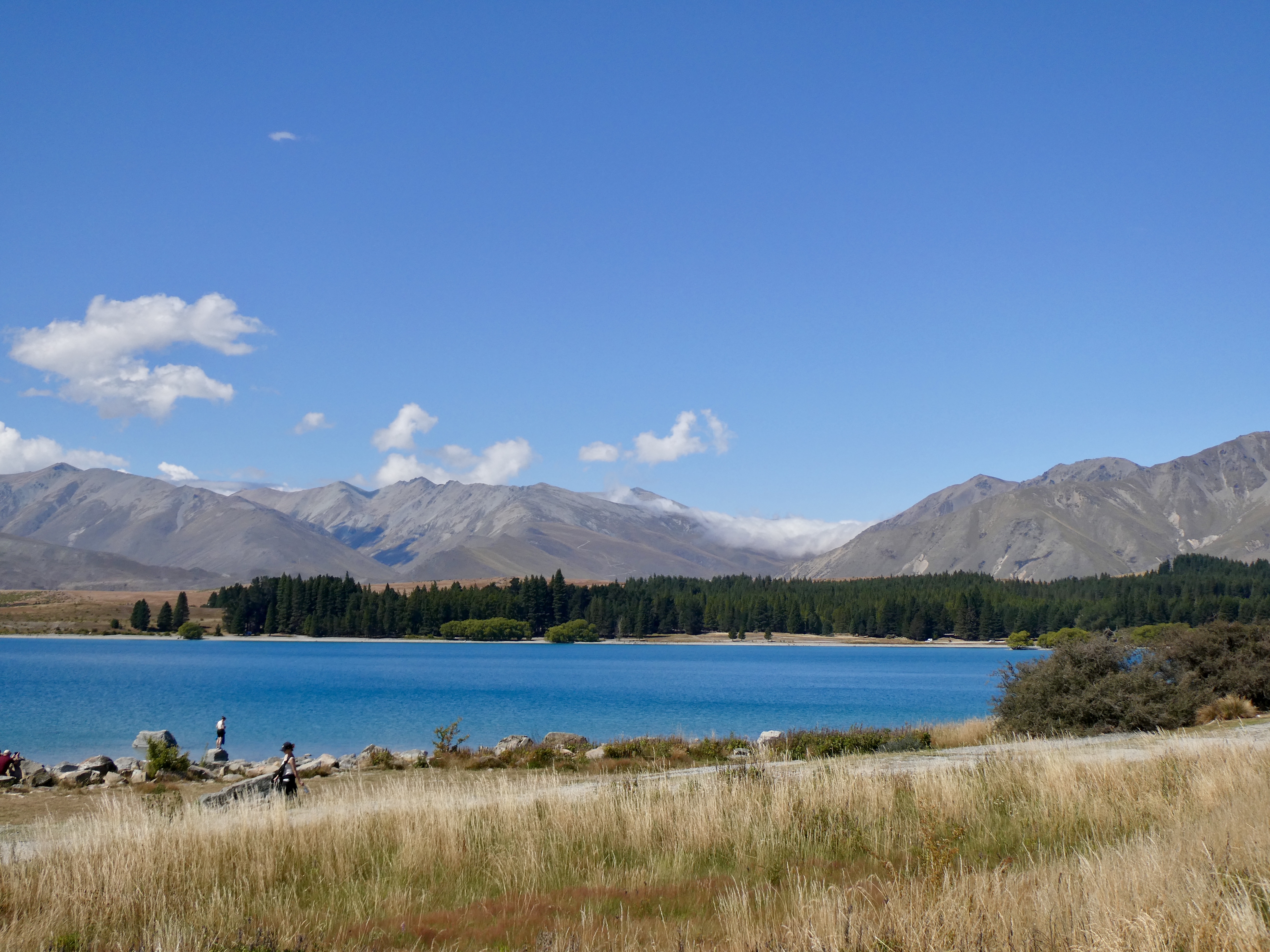
Anyway, once we travelled along the rolling hills abutting the Southern Alps, we arrived at Lake Tekapo (also a glacier fed lake with equally gorgeous aqua blue colours) and made a quick stop to take in the monument to sheep herding dogs, including the boarder collie and the the solitary Church of the Good Shepherd sitting above the vivid blue lake.
The first stone of the Church had been laid in 1935 by the Duke of Gloecester and was dedicated to the pioneers who had settled the area.
So after the brief stop, we moved away from the Southern Alp and into the diverse farmland of the Canterbury Plains passing numerous sheep, angus and milk farms before the farming turned to crops.
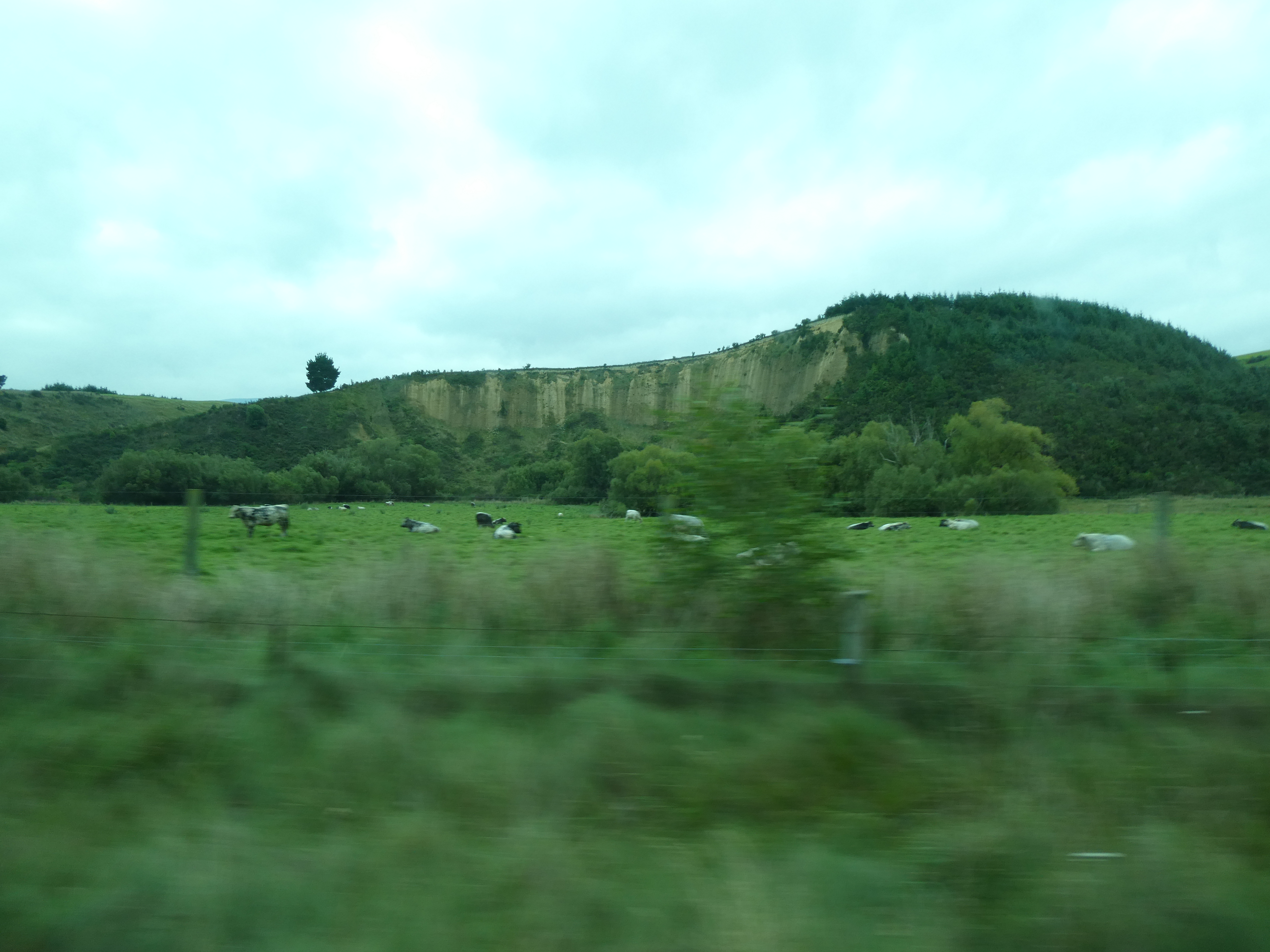

It wasn’t long before the landscape changed dramatically from rolling hills made out of clay (in fact we saw one hill sliced in half following a slide) to flat lands as we moved along the Inland Scenic Route (as opposed to the main highway). The route took us through a
number of small villages (it’s a village if it has a primary school, a church and a pub) before picking up the Thompson’s Trek, which took us across the longest bridge in New Zealand, the Rakaia bridge at 5,764 feet.
After passing over the bridge, we made a brief rest stop in Rakaia before continuing on for the final leg of our trip, passing by more farmland before hitting the outskirts of Christchurch. We finally reached Christchurch at just after 7:00 p.m. and fortunately, our stop was second in the city so we exited the bus, said goodbye to Grant and were checking into our hotel by 7:20 p.m., almost 12 hours after we boarded in Queenstown. It had been a long trek, but damn we saw (and learned a lot). Tomorrow we head to the North Island via train and ferry to Wellington.